News

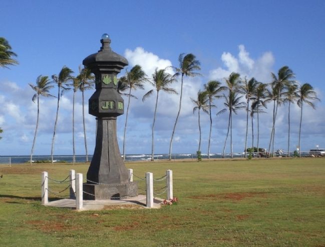
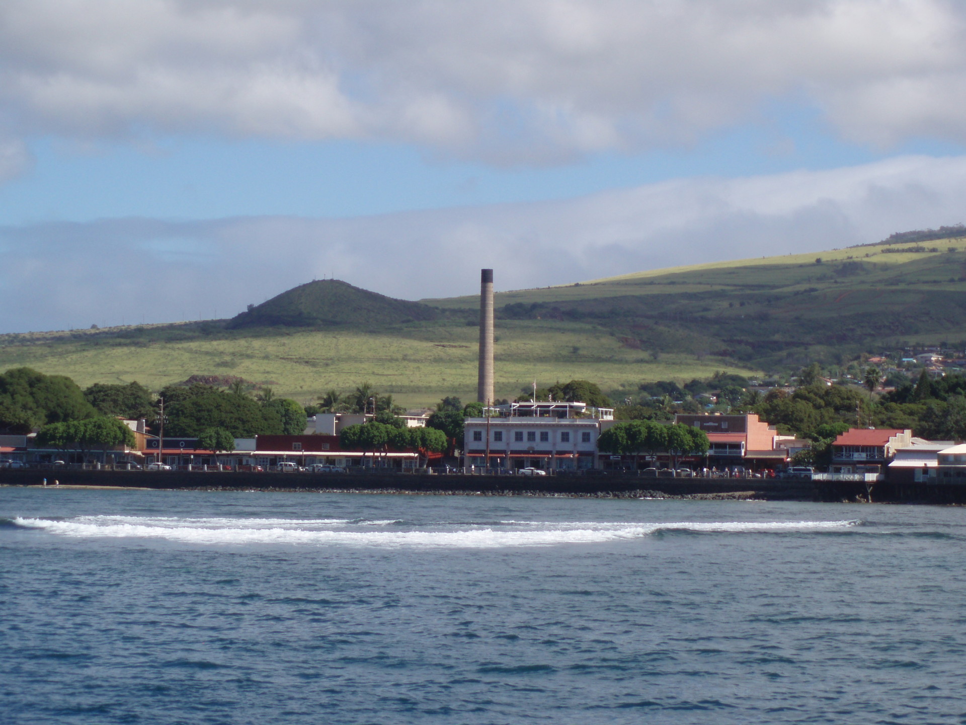
Lahaina Historic District (2010)

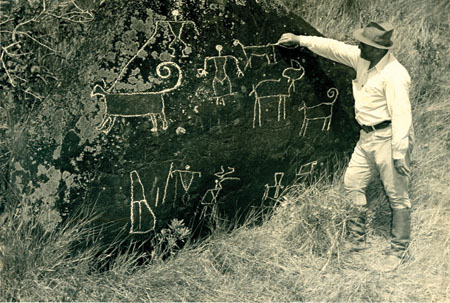
Article Written By: Jenny Quill, HONOLULU Magazine What is it? The first capital of the kingdom of Hawai‘i, Lahaina was also once a bustling whaling town and plantation settlement. To recognize and preserve its rich history, two sets of historic districts have been created in Lahaina: The Lahaina Historic District, which encompasses about 1,665 acres, was added to the National Park Service’s (NPS) National Historic Landmarks Program in December 1962. Maui County Historic District Boundaries 1 and 2 cover about 65 acres in Lahaina. “Historic District 1 was designated more for traditional historic sites such as the prison, the Masters’ Reading Room, some of the older churches, the Seaman’s Hospital,” says Ann Cua, the deputy director of the Maui County Planning Department. “Historic District 2 is where you have the commercial buildings on Front St.” What threatens it? The inclusion of the Lahaina Historic District on this list may come as a surprise to many, as it doesn’t appear to be crumbling to the ground. And, to be honest, it’s not; the danger here is far more insidious. “The threat is a long-term pattern of insensitive new construction and incompatible renovations to historic buildings,” says Kiersten Faulkner, executive director of the Historic Hawai‘i Foundation. “The National Park Service, which has oversight of National Historic Landmarks, has noted this pattern as starting to undermine the integrity of the district. It is not an issue of individual sites as much as it is a cumulative effect of countless individual decisions.” Indeed, a 2008 report by the National Parks Service listed the district as threatened, which NPS defines as “any landmarks that have suffered or are in eminent danger of a severe loss of integrity.” The report specifically [...]

2016-11-17T11:46:19-10:00March 3rd, 2014|Categories: MES Maui|Tags: , |

Ka‘a Ahupua‘a (2011)

“It is irreparable damage to such a beautiful place in return for very little for our community.” Robin Kaye Photos: Courtesy of Robin Kaye UPDATE: 2011 Public meetings were held on Maui, Moloka‘i and Lāna‘i to gather comments on a "programmatic" environmental impact statement on the Hawaii Inter-island Renewable Energy Program. A traditional cultural properties study of Ka‘a Ahupua‘a was completed in April of 2011 by Kepā and Onaona Maly for The Lāna‘i Culture & Heritage Center. LISTED AS ENDANGERED IN 2011 Article Written By: Victoria Wiseman, HONOLULU Magazine What Is It? The Landscape of the 20,000-acre Ka’a Ahupua’a on the west side of Lāna‘i is unspoiled and mostly uncharted, with little known about the cultural importance of the area is undeniable: A limited 2011 survey identified 294 cultural features, such as ceremonial sites, petroglyphs, heiau and burial locations. The ahupua’a also serves an important community purpose, providing food to local subsistence hunters and fishers. What Threatens It? Historic preservation and the pursuit of alternative energy are both well-intentioned movements in society. However, not everyone agrees that both can happen in the Ka’ Ahupua’a. In 2008, landowner Castle & Cooke Resorts LLC was permitted to build a 170-turbine, 400-Megawatt wind farm in the ahupua’a. Community group Friends of Lāna‘i is against the project. “It is irreparable damage to such a beautiful place in return for very little for our community,” says Robin Kaye. The construction of the turbines, roads, and power facilities would significantly alter the landscape, and all of the power generated would go to Oahu. The only benefit to Lāna‘i would be a handful of permanent jobs, he says. In 2009, after public input, the Public Utilities Commission decided to reexamine the project [...]

2016-11-17T11:43:22-10:00March 3rd, 2014|Categories: MES Lanai|Tags: , |

Luahiwa Petroglyphs, Kealiakapu ahupua‘a (2009)

Chalking petroglyphs, as shown in the photo, is one of the practices that have damaged these ancient carvings.  Photos: Courtesy of Kepa Maly Article Written By: Jenny Quill, HONOLULU Magazine What is it? Located on a difficult-to-find, 3 acre section of land in central Lāna‘i, Luahiwa is one of Hawai‘i’s most significant Ki‘ipōhaku, or petroglyph, complexes, with close to 1,000 ancient stone carvings etched into the sides of boulders scattered across the slope. According to Kepa Maly, the executive director of the Lāna‘i Culture and Heritage Center, 95 percent of the drawings are of pre-Western-contact forms, including canoes, human shapes, animals, dogs, turtles and processions of men. “The other interesting thing about the complex” says Maly, “is that you can see that it has been used generationally. When one set of images were beginning to fade out due to centuries of exposure to weather, new images were put over them. You can still see the juxtaposing of image over image”. What threatens it? There are several environmental factors: A fire in October 2007 burned through the region, cracking the rocks; soil erosion resulting from the removal of vegetation has undermined the stones. Then there’s the human factor. In recent years, one of the ancient dog images was redrawn as a deer with antlers. People have also crudely carved their names into the boulders, while others have used acrylic, chalk or wax to make the carvings more visible for viewing and recording. What can be done? Maly would like to establish an area for boardwalk that leads to viewing platform outfitted with interpretative signage. This setup would ensure that visitors could still get a glimpse of the ancient stone carvings, and diminish the potential for additional [...]

2017-04-21T01:01:46-10:00March 3rd, 2014|Categories: MES Lanai|Tags: , |

The Alakoko Pond, Nawiliwili 2009

UPDATE 2023 Mālama Hulē’ia's Community Workday, Restoring the Alakoko Fishpond In 2009, the Alakoko* Fishpond was placed on Historic Hawai‘i Foundation’s list of Hawai‘i’s Most Endangered Historic Places. For most of the 20th century, Alakoko was neglected, becoming overrun by invasive red mangrove; which damaged the historic fishpond wall, covered open wetlands, and trapped sediment that steadily shrank the fishpond’s expanse of open water. In June 2022, Historic Hawai‘i Foundation’s Preservation Grant program—made possible by special support from preservation funders—awarded a grant to Mālama Hulē'ia to stabilize and restore the kuapā (fishpond wall) of the Alakoko Loko I‘a. With help from the grant, Mālama Hulē'i‘a held a 5-year Anniversary community workday on October 21, 2023 to repair the kuapā. Thousands of community members gathered at the Alakoko Fishpond as people of all ages stood formed a line that extended over half-mile, each placing rock after rock on an ancient wall that protects Alakoko Fishpond. “Alakoko fishpond is a link to the essence of what it means to grow your own food. It’s a link to the culture and the history of the people who cared for this place. So, it really links the past, current, and future ‘āina movement.” Mālama Hulē‘ia Executive Director Sara Bowen This community effort to restore a treasured historic site provides an example of the importance and strength of intergenerational and cultural transfer of knowledge. To learn more about the impact of this community workday on the Alakoko Fishpond, please visit Mālama Hulē'i‘a. Images above, clockwise from top left: Alakoko Fishpond in December 2018, photo taken from the lookout showing it overgrown with mangrove; Alakoko Fishpond in August 2019, photo taken from the lookout showing mid-waypoint of mangrove removal project (approximately [...]

2024-04-08T15:10:58-10:00March 3rd, 2014|Categories: MES Kauai|Tags: , |

Coco Palms (2008)

Photos: Courtesy of Timothy Dela Vega UPDATE: 2013 Article Written By: Victoria Wiseman, HONOLULU Magazine A developer has finally purchased this defunct historic resort, which was ravaged by Hurricane ‘Iniki in 1992. Ron Agor, the architect on the project, is dedicated to maintaining its historic integrity. “We are rebuilding structures that can’t be saved on the same footprint,” he says. “All we’re really doing is replacing wooden walls with windows with big glass and putting a railing up. We’re keeping all the structural elements. The whole idea is not to dig the earth, because it’s pretty sacred land. Even if one doesn’t believe in the spiritual, you’re compelled to respect other people’s beliefs.” LISTED AS ENDANGERED IN 2008 Article Written By: Michael Keany, HONOLULU Magazine What is it? The Coco Palms is one of Hawaii's most renowned classic resorts. Owner Grace Guslander pioneered romantic traditions that have become de rigueur in the local hospitality industry, such as the torch-lighting ceremony. The site's historical significance predates the resort, though. It was long a favorite center for Hawaiian monarchy; High Chief Deborah Kapule lived there in the mid-1800s, and cultivated fishponds in the area. What threatens it? Hurricane Iniki hit the resort hard in 1992, and the Coco Palms has been shuttered ever since. Not for lack of interest in reopening it. As Kauai historian Pat Griffin says, "There is general agreement that it is an enormously important cultural and historical site, and should be protected." But no one has yet been able to make the numbers work. What can be done? There are a couple of ideas afloat, but both of them require money that hasn't materialized yet.The property's current owner, Phillip Ross, of Coco Palms Ventures LLC, based in Annapolis, Md., says he's working to re-open the Coco Palms [...]

2016-11-17T11:40:31-10:00March 3rd, 2014|Categories: MES Kauai|Tags: , |

Grove Farm Manager’s House (2007)

Photos: Courtesy of The State Historic Preservation Division Article Written By: Michael Keany, HONOLULU Magazine What is it? This two-story, six bedroom mansion was built in 1913 as a manager’s house for the Grove Farm sugar plantation on Kaua‘i. With a driveway lined by royal palms and a large porte cochere to greet visitors, the home was once an impressive sight. Grove Farm founder George Wilcox’s nephew Charles was its first resident, and it later housed a succession of plantation managers. The plantation ceased sugar operations in 1974, however, and the house has not been occupied for many years. What threatens it? Neglect, for the most part. The house sits vacant and cordoned off, and exposure is taking its toll. The roof of the porte cochere has collapsed, and the house still suffers from the damages it incurred 15 years ago during Hurricane ‘Iniki. Some community members also fear that the manager’s house could be slated for replacement. America Online co-founder Steve Case bought the plantation- turned-land-development-company in 2000, and is planning a subdivision on the land surrounding the house. Robert Schleck, director of the Grove Farm Homestead Museum, says he’d hate to see the manager’s house go. “There are a lot of developments along Nawiliwili Road, and so that property affords a kind of open space, instead of hollow- tile walls and the closed-in feeling you get otherwise,” he says. What can be done? Grove Farm’s development plans for the area are still pending approval from various government agencies. In the meantime, it has no definite plans to restore the manager’s house. In an official response, the company states, “While Grove Farm is interested in retaining the original ambience of the manager’s house … [...]

2016-11-17T11:40:40-10:00March 3rd, 2014|Categories: MES Kauai|Tags: , |

Gulick Rowell House, Waimea (2006)

Photos: Courtesy of David and Sue Boynton Article Written By: Michael Keany, HONOLULU Magazine What is it? Amazingly, this two-story coral limestone house in Waimea, Kaua‘i, has been in almost continuous use as a residential home since missionary Peter Gulick built it more than 178 years ago. “It’s got all this wonderful history spanning from the missionary times through to the sugar era,” says Linda Faye Collins, president of the Kikiaola Land Co., an offshoot of the original Waimea Sugar Mill Co., which has long owned the property. The house became a home for the sugar company’s plantation managers, and, at one point, its basement even served as the town jailhouse. Today the Gulick-Rowell House is prized by historic-minded community members and architects as an irreplaceable example of traditional New England architecture in Hawai‘i. What threatens it? The litany of woes you’d expect from a house nearing its bicentennial—sagging wood floors, water damage, cracks in the foundation, to name a few. A 1997 inspection estimated the cost of renovation at $1.2 million, a figure that can only have grown since then. The situation has taken on a new urgency this year: The two sisters who have lived in the house their entire lives are moving out. Architect Bob Fox, who helped inspect the building, says vandalism and environmental wear and tear now pose increased threats to the newly empty home. “Once a house is unoccupied, it’s amazing how quickly it deteriorates. I don’t know what it is, but it seems like the whole building gives up and just rots away,” he says. What can be done? Kikiaola Land Co. is looking to create a nonprofit organization to raise funds for repair and renovation. Possible solutions [...]

2016-11-17T11:40:52-10:00March 3rd, 2014|Categories: MES Kauai|Tags: , |

Hanalei Pier Canopy (2012) SAVED

UPDATE: SAVED IN 2013 The rebuilt canopy at the end of Hanalei Pier recently reopened after a reconstruction project was completed by the Rotary Club of Hanalei Bay. Prior to the reconstruction effort, which began in March and concluded in May, the canopy suffered from dry rot and cracked beams, holes in the roof and broken support struts. The State Department of Land & Natural Resources, Kaua’i Division of Boating and Ocean Recreation planned to demolish the structure, prompting HHF to declare it an Endangered Historic Place. The Rotary Club of Hanalei Bay established a “Save the Pier” project involving the community, the State of Hawai‘i, and the County of Kaua‘i to preserve the historic and community landmark. Members worked with the state’s Department of Land and Natural Resources on reconstruction plans while raising money to restore what has become a symbol of Hanalei Bay. Rotary Club raised more than $188,000 to rebuild and provide upkeep to the community icon. Originally constructed of wood, the Hanalei Pier has been in existence since 1892. In the early 20th century, the pier was a major hub for the transportation of rice, sugar and various goods between the other Hawaiian Islands and the rest of the world via the Pacific Ocean. It became a recreational resource in the last 80 years when shipping halted and is a popular venue for fishing, picnics and filming. LISTED AS ENDANGERED IN 2012 Article Written By: Kathryn Drury Wagner What is it? Originally built for rice transportation, this picturesque pier is now valued for recreational use. “It’s a historic part of Hanelei and it’s important to the community for fishing and picnicking,” says Barbara Robeson, a longtime resident and a consultant on preservation [...]

2017-04-21T01:01:46-10:00March 3rd, 2014|Categories: MES Kauai|Tags: , |

Kapa’a Stone Lantern, Kapa’a (2005) SAVED

UPDATE: SAVED IN 2009 Kapaa Business Association partnered with volunteers from Leadership Kauai and the Kauai Historical Society to restore Kapaa's historic Japanese Stone Lantern in Kapaa Beach Park. The project won a 2009 American Association for State and Local History Award of Merit. LISTED AS ENDANGERED IN 2005 Article Written By: A. Kam Napier, HONOLULU Magazine What is it? This 15-foot cast concrete lantern was built in 1915 by Kauai's Japanese community to commemorate the Russo-Japanese War of 1905 and to honor the 1912 ascension to the throne of Emperor Taisho. By World War II, however, these pro-imperial sentiments were a problem for a later generation of Japanese- Americans who, in 1943, literally buried the lantern, both to protect it from vandalism during a time of anti-Japanese sentiment and as a display of pro-American loyalty. Once buried, it was forgotten until 1972, when the parents of children playing soccer at Kapaa Beach Park complained about a dangerous piece of steel rebar sticking out of the ground. Work crews discovered that the rebar was attached to a buried monument-- but one that no one wanted to claim. The lantern was reburied 24 hours later. In 1987, Mayor Tony Kunimura led an effort to unearth the lanterns, with the help of the Kauai Historical Society. The lantern was moved to the corner of the beach park and braced. What threatens it? Exposure to the elements threatens the monument. Being buried and dug up, twice, damaged the lantern. Now even the metal braces on the lantern are rusting and damaging the concrete. "There are several serious cracks and breaks in the concrete structure... and in many places the concrete is broken or crumbling away," reports Mary Requilman, [...]

2016-11-17T11:41:14-10:00March 3rd, 2014|Categories: MES Kauai|Tags: , |

Kapaia Swinging Bridge (2011) SAVED

UPDATE: 2018 – Reconstruction Underway The Kapaia Foundation’s March Newsletter shared an inspiring update on the status of Kapaia Swinging Bridge’s reconstruction! "HD Construction, with the guidance of architect Ron Agor, has been busy working on rebuilding the Kapaia Swinging Bridge since last September. Contractor Harry Duronslet and his team are following the 1948 plan, using as much of the existing material as possible. The finished structure will look like the original but will last longer because it is being built stronger. If all goes as planned, the bridge rebuild project should be completed before May 2018." UPDATE: 2017 – SAVED After more than a decade of neglect, Kapaia Swinging Bridge is on its way to being restored. In March of 2017, Kaua’i County transferred appropriated funds and ownership of the bridge to Kapaia Foundation. Kapaia Foundation, formed in 2006 to seek protection of the bridge, was awarded a $231,000 grant to cover supplies and equipment to restore the bridge.  Kapaia Foundation is galvanizing the community for the additional support and services needed.   Photos: courtesy of Kicka Witte; Kapaia Foundation “Maintenance neglect and resistance from county leaders created the dilemma we have struggled with for the past five years.” – Laraine Moriguchi UPDATE: 2012 – CONTINUED THREAT Article Written By: Kathryn Drury Wagner In last year’s “Most Endangered Places,” we covered the Kapaia Swinging Bridge, a wooden suspension bridge constructed in 1948. A vestige of the plantation culture in the Islands, in 2006, It was deemed unsafe and closed by the county. Things had been looking up: the county was planning to restore the bridge’s two towers, and a community group, Save Kapaia Swinging Bridge, was raising the funds for the rest of the renovation. [...]

2018-03-19T11:47:28-10:00March 3rd, 2014|Categories: MES Kauai|Tags: , |
Go to Top