MostEndangered2009

The 33 Structures in the Path of Honolulu’s Rapid Transit Project (2009)

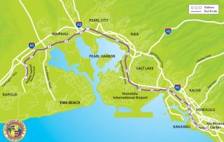
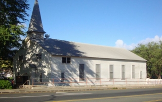
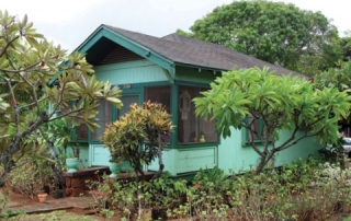
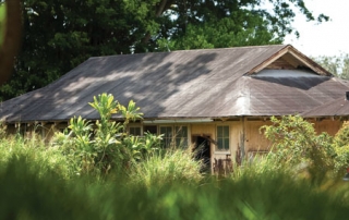
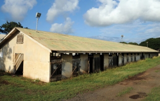
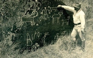
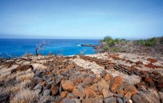
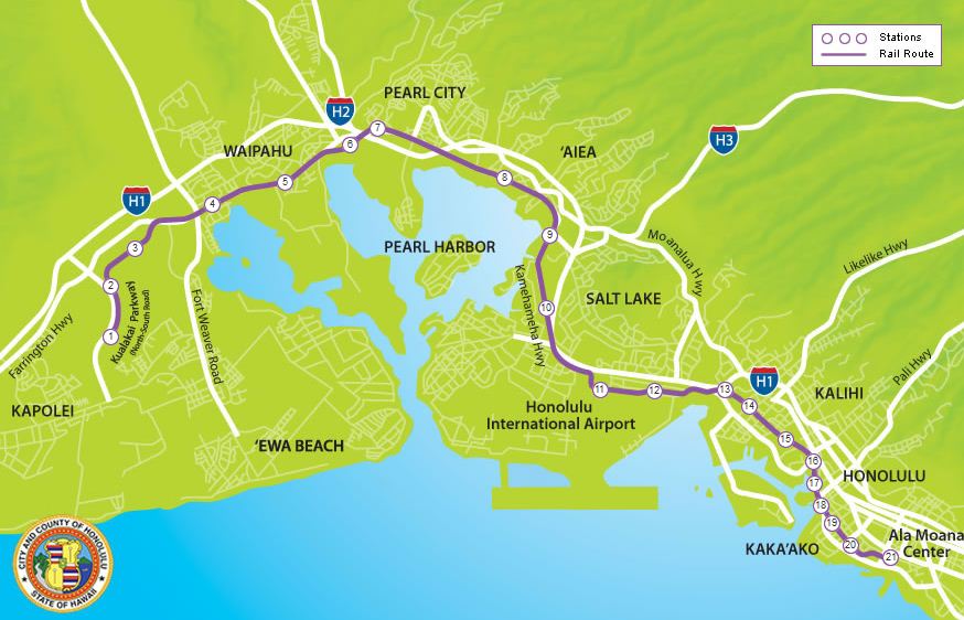
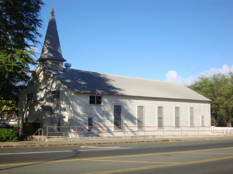
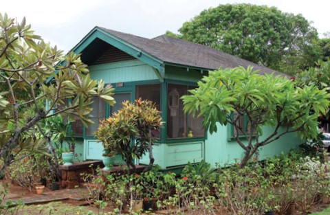
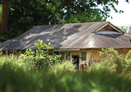
Photos: Courtesy of honolulutransit.org Article Written By: Jenny Quill, HONOLULU Magazine What is it? The 20-mile elevated rail line will connect West O‘ahu with downtown Honolulu and Ala Moana Center once it’s completed in 2019. The Historic Hawai‘i Foundation (HHF) has identified 33 historic sites between ‘Ewa and Kaka‘ako that will be impacted, with potential outcomes ranging from demolition to being transformed into a rail station. These sites include the Aloha Chapel, designed by renowned architect Vladimir Ossipoff; CINCPAC, the headquarters for the Commander in Chief, Pacific Command; and the Dillingham Transportation Building.   What Threatens It? Given the scale of the project, Honolulu’s rail transit system will profoundly alter the face of the communities through which it passes. “Although the Historic Hawai‘i Foundation supports improved transportation options for Honolulu,” says executive director Kiersten Faulkner, “we remain concerned that the proposed system will have negative impacts on dozens of historic sites along the route. The adverse effects on over 30 historic properties, including at least three historic districts, will fundamentally change the cultural landscape of O‘ahu and forever diminish the civic experience in Honolulu’s historic areas.” In its defense, the Department of Transportation Services issued the following statement: “Various alternatives were considered before the selection was made of the currently proposed system and alignment. One of the considerations used in the evaluation of the alignments was impacts to environmental resources, such as historic resources.” What can be done? According to the DTS, “an agreement to minimize or mitigate the project’s adverse impact on the above historic resources is presently being developed.” Of the 33 identified historic sites, the rapid transit project will affect only the Afuso House, Higa Fourplex, Teixeira House, Lava Rock Curbs, Kapalama Canal [...]

2016-11-17T09:16:22-10:00March 3rd, 2014|Categories: MES Oahu|Tags: , |

Chapel at Kapiolani Community College (2009) SAVED

UPDATE: SAVED IN 2013 Repairs to reverse wood rot and termite damage at the historic Ft. Ruger chapel have been completed by Kapi‘olani Community College. The work was funded by a $575,000 capital improvement project appropriation from the state legislature in 2010 for interior repairs, maintenance, refurbishment work, new paint and a new roof for the chapel. The white chapel located on the Diamond Head side of the Kapi‘olani Community College (KCC) campus has always stood out from KCC’s low-lying, 1980s architecture. Built in 1925, the chapel hosted church services for the Fort Ruger military community, O‘ahu’s earliest U.S. Army coastal defense fortification, established in 1909. The Friends of the Chapel worked with KCC and state officials, especially then-Representative Barbara Marumoto, to secure the funding and see the project to its successful outcome. UPDATE: 2010 Article Written By: Jenny Quill, HONOLULU Magazine Good things come to those who wait, and it seems that the chapel, which is still being used for classes and other activities, might finally get some much needed TLC. Recent legislation (House Bill No. 2303) appropriated $575,000 for interior repairs, maintenance, refurbishment work, new paint and a new roof for the chapel. The bill took effect in July, and the funds released. Additionally, KCC recently presented its long-range plan to the University of Hawai‘i Board of Regents. “The chapel was identified as one of the most cherished places on the campus,” says Carol Hoshiko, the dean for Culinary, Hospitality and College Advancement. “In addition to the chapel, it was proposed that there be an auxiliary building [built] next to the chapel for joint use for the community and the campus.” The development plan was “approved in principle” by the board, meaning that, [...]

2017-04-21T01:01:41-10:00March 3rd, 2014|Categories: MES Oahu|Tags: , |

Hale‘iwa Residences (2009)

Photos: Courtesy of Rae Huo Article Written By: Jenny Quill, HONOLULU Magazine What is it? Built in the early 20th century, these four residences located on Kamehameha Highway in Haleiwa are some of the few remaining plantation-style homes along the historic town’s main thoroughfare. “This property represents a piece of Old Hawaii plantation architecture, and part of that adds to Haleiwa’s charm,” says Antya Miller, a member of the North Shore Neighborhood Board. What threatens it? Owner Scott Wallace, who purchased the houses a couple of years ago, hired Plan Pacific, a Honolulu-based planning firm, to assess the physical condition of the homes for historic preservation or adaptive reuse, and to then devise a plan and request the necessary zoning change from a residential to a business district. Plan Pacific’s assessment was not in favor of historic preservation. “It would cost a lot [to preserve them],” says Plan Pacific president John Whalen. "The problem was for years the houses weren't well-maintained. They were in a cosmetic way, they looked OK, but some big issues weren't addressed. There are cesspool problems, termite damage, basic plumbing and electrical problems. They're still habitable, but they're reaching a point where they're not going to be." Plan Pacific has devised a plan for a single-story commercial building fronting Kamehameha Highway and three live-work units placed behind it. Because the property is located within the Hale‘iwa Special District, both the live/work units and the commercial building will have to adhere to the district’s strict design guidelines. While that’s all fine and good, says Miller, she doesn’t believe that the original charm and character of the houses could ever be replicated. “The primary reason that most of us want that property preserved [...]

2017-04-21T01:01:41-10:00March 3rd, 2014|Categories: MES Oahu|Tags: , |

Waimano Ridge (2009) LOST

Photos: Courtesy of David Croxford Update: 2010 Article Written By: Jenny Quill, HONOLULU Magazine According to Janice Okubo, a spokesperson for the Hawai‘i state Department of Health, the 12 support buildings built between 1936 and 1954 at Waimano Ridge, formerly Waimano Training School and Hospital, are set to be demolished. At press time, a contract had been awarded for the demolition of the structures and work was expected to begin within a few months. LISTED AS ENDANGERED IN 2009 Article Written By: Jenny Quill, HONOLULU Magazine What is it? Located on approximately 265 acres of land above Pearl City residential neighborhoods, Waimano Ridge was home to the Waimano Training School and Hospital (WTSH), an institutional incarceration facility for people with developmental disabilities. Established in 1919, the hospital, which was originally known as the Waimano Home for the Feebleminded, was shuttered in 1999 following years of rumors about dingy conditions and questionable patient treatment. Today, Waimano Ridge is a medical facility in transition. It currently hosts a number of state organizations and programs: The old Waimano Training School and Hospital was renovated and is being used by the Department of Public Safety. Other buildings house Department of Health (DOH) offices, the DOH Laboratory facility, Mental Health Transformation State Incentive Grant offices and a juvenile sex offender program. “[Waimano Ridge] is definitely being used, which is appropriate given our terrible economic situation,” says DOH director Dr. Chiyome Fukino. What threatens it? Following the hospital’s closure, its support buildings, the oldest of which were built in the mid-1930s, and the newest of which, Hale Aloha, was built in 1977, languished into disrepair until the Department of Health decided to transform Waimano Ridge into a modern medical community. Bringing the site up to code, however, has required significant updating. [...]

2017-04-21T01:01:42-10:00March 3rd, 2014|Categories: MES Oahu|Tags: , |

Hali‘imaile Stables (2009)

Photos: Courtesy of Matt Thayer Article Written By: Jenny Quill, HONOLULU Magazine What is it? The stables, which are located across from the Hāli‘imaile General Store restaurant, were built around 1920 as part of the old Hāli‘imaile plantation village. “The stables were built before my time,” says Eddie Ceballos, who worked as a field hand and service station attendant for Maui Pineapple Co., now Maui Land & Pineapple Co. (ML&P), for 50 years. “The stables were for the mules and horses, which were used to cultivate and plow between the pineapple lines, to keep the weeds down.” “When I was cognizant of them, it was just past the time when they had been used for the mules and horses,” says Mary “Maizie” Sanford, whose grandfather and father owned and operated Maui Pineapple Co. “I think they were just being used to store different kinds of machinery and vehicles. They’re very picturesque, with all those beautiful trees around them. It would be a shame to lose them.” What threatens it? In May 2008, ML&P submitted a building permit application to demolish the stables. When contacted for additional information regarding the demolition and any future plans for the site, ML&P declined to comment. What can be done? Because the demolition seems to have been kept fairly under wraps, no one is currently working on an alternative solution. However, Nancy McMahon, the deputy This past August the Air Force an-state historic preservation officer for the State Historic Preservation Division, would like to see that the stables remain standing. “I think adaptive reuse for vendors or houses, the chapel and flagpole, and crafts would be ideal,” says McMahon. But without a community alternative to demolition or the cooperation of [...]

2017-04-21T01:01:46-10:00March 3rd, 2014|Categories: MES Maui|Tags: , |

Luahiwa Petroglyphs, Kealiakapu ahupua‘a (2009)

Chalking petroglyphs, as shown in the photo, is one of the practices that have damaged these ancient carvings.  Photos: Courtesy of Kepa Maly Article Written By: Jenny Quill, HONOLULU Magazine What is it? Located on a difficult-to-find, 3 acre section of land in central Lāna‘i, Luahiwa is one of Hawai‘i’s most significant Ki‘ipōhaku, or petroglyph, complexes, with close to 1,000 ancient stone carvings etched into the sides of boulders scattered across the slope. According to Kepa Maly, the executive director of the Lāna‘i Culture and Heritage Center, 95 percent of the drawings are of pre-Western-contact forms, including canoes, human shapes, animals, dogs, turtles and processions of men. “The other interesting thing about the complex” says Maly, “is that you can see that it has been used generationally. When one set of images were beginning to fade out due to centuries of exposure to weather, new images were put over them. You can still see the juxtaposing of image over image”. What threatens it? There are several environmental factors: A fire in October 2007 burned through the region, cracking the rocks; soil erosion resulting from the removal of vegetation has undermined the stones. Then there’s the human factor. In recent years, one of the ancient dog images was redrawn as a deer with antlers. People have also crudely carved their names into the boulders, while others have used acrylic, chalk or wax to make the carvings more visible for viewing and recording. What can be done? Maly would like to establish an area for boardwalk that leads to viewing platform outfitted with interpretative signage. This setup would ensure that visitors could still get a glimpse of the ancient stone carvings, and diminish the potential for additional [...]

2017-04-21T01:01:46-10:00March 3rd, 2014|Categories: MES Lanai|Tags: , |

The Alakoko Pond, Nawiliwili 2009

UPDATE 2023 Mālama Hulē’ia's Community Workday, Restoring the Alakoko Fishpond In 2009, the Alakoko* Fishpond was placed on Historic Hawai‘i Foundation’s list of Hawai‘i’s Most Endangered Historic Places. For most of the 20th century, Alakoko was neglected, becoming overrun by invasive red mangrove; which damaged the historic fishpond wall, covered open wetlands, and trapped sediment that steadily shrank the fishpond’s expanse of open water. In June 2022, Historic Hawai‘i Foundation’s Preservation Grant program—made possible by special support from preservation funders—awarded a grant to Mālama Hulē'ia to stabilize and restore the kuapā (fishpond wall) of the Alakoko Loko I‘a. With help from the grant, Mālama Hulē'i‘a held a 5-year Anniversary community workday on October 21, 2023 to repair the kuapā. Thousands of community members gathered at the Alakoko Fishpond as people of all ages stood formed a line that extended over half-mile, each placing rock after rock on an ancient wall that protects Alakoko Fishpond. “Alakoko fishpond is a link to the essence of what it means to grow your own food. It’s a link to the culture and the history of the people who cared for this place. So, it really links the past, current, and future ‘āina movement.” Mālama Hulē‘ia Executive Director Sara Bowen This community effort to restore a treasured historic site provides an example of the importance and strength of intergenerational and cultural transfer of knowledge. To learn more about the impact of this community workday on the Alakoko Fishpond, please visit Mālama Hulē'i‘a. Images above, clockwise from top left: Alakoko Fishpond in December 2018, photo taken from the lookout showing it overgrown with mangrove; Alakoko Fishpond in August 2019, photo taken from the lookout showing mid-waypoint of mangrove removal project (approximately [...]

2024-04-08T15:10:58-10:00March 3rd, 2014|Categories: MES Kauai|Tags: , |

Lapakahi (2009) SAVED

Photos: Courtesy Kirk Lee Aeder UPDATE: SAVED IN 2011 Coastal Property Added To Lapakahi State Historical Park Endangered Historic Property HONOLULU, March 18, 2011 - The State of Hawai‘i, Department of Land and Natural Resources, Division of State Parks announced the addition of 17 shoreline acres to Lapakahi State Historical Park in North Kohala on the Island of Hawai‘i, located in an area traditionally known as Nu‘uanu. The parcel will be added to the Lapakahi State Historical Park, which is listed in the National and Hawai‘i Registers of Historic Places as an excellent example of a leeward coastal settlement that spans a 600 year period from circa A.D. 1300 to the early 1900s. The 17-acre parcel has significant cultural sites that are part of this larger Lapakahi complex and the potential for development of the parcel under private ownership resulted in its recent listing as one of Hawai'i's Most Endangered Places by Historic Hawai‘i Foundation. "This parcel was surrounded on three sides by Lapakahi State Historical Park with the fourth side being adjacent to the Lapakahi Marine Life Conservation District. It has been the State’s desire for many years to acquire this property and include it within the park as part of the larger Lapakahi complex. The 17 acres are a vital piece of a cultural and biological landscape of the Kohala coastline, and we are thankful that future generations will have an opportunity to appreciate this cultural complex within its natural setting and to enjoy the open space and access to the shoreline," stated William Aila, Jr., Director of the Department of Land and Natural Resources. The acquisition was assisted by a diverse public-private partnership of Kohala community organizations, the Trust for Public Land (a [...]

2016-11-17T10:48:37-10:00March 3rd, 2014|Categories: MES Hawaii|Tags: , |
Go to Top