
Visit Hawai‘i’s Historic Places on Hawai‘i Island
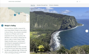
Honoka‘a Story Map: He Koaʻe, Manu o ka Pali Kahakō
Historic Hawai‘i Foundation developed the Honoka‘a Story Map in collaboration with project partners, Cultural Surveys Hawai‘i; the University of Hawai‘i at Hilo, History Department and Professor Kerri Inglis; Honoka‘a Heritage Center and members of the Historic Honoka‘a Town Project. Students from UH Hilo contributed to the research and content of the map as part of their history course curriculum under the direction of Professor Inglis. The project also enlisted three student interns who worked closely with Professor Inglis and contributed research, contextual essays, and photography.
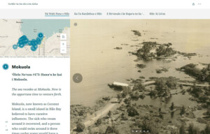
Hilo Story Map: Nā Wahi Pana o Hilo
Historic Hawai‘i Foundation developed the Hilo Story Map in collaboration with project partners, Cultural Surveys Hawai‘i; the University of Hawai‘i at Hilo, History Department and Professor Kerri Inglis; ASM Affiliates senior archaeologist Lokelani Brandt; and Lyman Museum. Students from UH Hilo contributed to the research and content of the map as part of their history course curriculum under the direction of Professor Inglis. The project also enlisted three student interns who worked closely with Professor Inglis and contributed research, contextual essays, and photography.

Historic Honoka‘a Town Map
This map of historic Honoka‘a Town, located on the Hamakua Coast of the Island of Hawaii, is part of the Historic Honoka‘a Town Project documenting 73 historic sites. The book, Honoka‘a Town, a more comprehensive dive into local history, is available at stores in Honoka‘a.
First settled as a stage stop in the nineteenth century, Honoka‘a takes its name from the sound of the sea nearby, “rolling bay”.
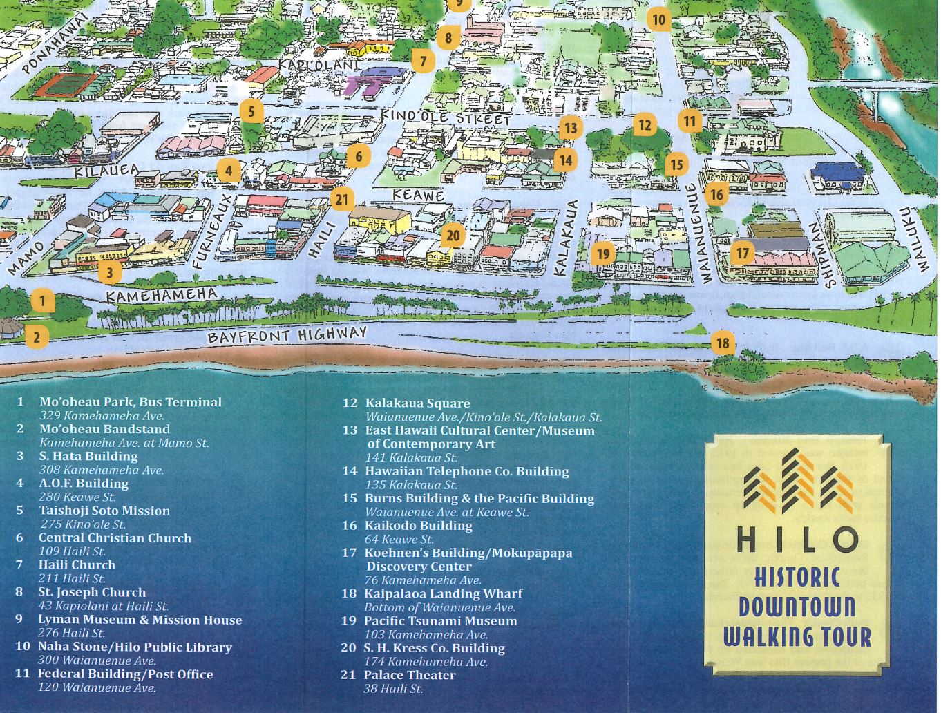
Historic Downtown Hilo Map
This self guided tour of historic Hilo highlights 21 sites providing information about the town’s history dating from 1870 to the present. A fascinating summary of historic events that have shaped Hilo such as the arrival of Polynesians, Missionaries, explorers, the expansion of trade and two tsunamis is included.

Kona Royal Footsteps App
Trace the paths of seven centuries of Hawaiian Royalty and tradition. The Kona Royal Footsteps APP is an interpretive experience that focuses on Alii Drive’s roughly seven miles of roadway, the state’s second scenic byway, with seven centuries of archaeological, historic and cultural traditions and more than two dozen impressive points of interest. Follow the scenic byway along Ali’I Drive from Historic Kailua Village to Keauhou.
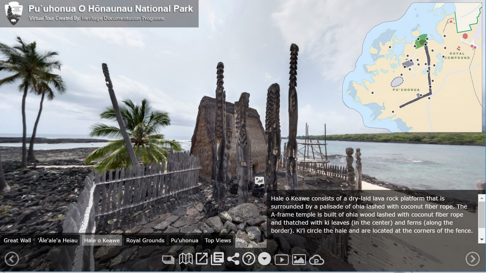
Pu’uhonua o Honaunau National Historical Park Virtual Tour
Take a virtual tour of Pu’uhonua o Honaunau National Historical Park created by Heritage Documentation Programs. This 180-acre national historic park was once the home of royalty and a place of refuge. Ancient Hawaiians who broke sacred law or kapu could avoid certain death by fleeing to this place of refuge or puʻuhonua. The offender would be absolved by a priest and freed to leave. Defeated warriors and non-combatants could also find refuge here during times of battle. Tour includes Hale o Papa, ‘Āle‘ale‘a Heiau, Hale o Keawe, Royal Grounds and Pu’uhonua.
Hawai‘i Volcanoes National Park Virtual Tour
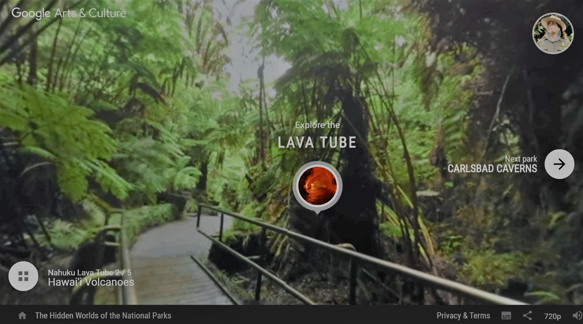
This exciting virtual tour is set in Hawai‘i Volcanoes National Park, home to some of the most unique geological, biological, and cultural landscapes in the world. Extending from sea level to 13,677 feet, the park encompasses the summits of two of the world’s most active volcanoes – Kīlauea and Mauna Loa. Visit the Nahuku lava tube and coastal volcano cliffs, fly over the Halema‘uma‘u Crater, & watch footage of the 1959 eruption and more. Your adventure is richly narrated by Ranger Andrea Kaawaloa-Okita who grew up in Volcanoes National Park and comes from a long line of park rangers.
Want to explore more? Watch Kīlauea – Summit webcams for live footage courtesy USGS Hawaiian Volcano Observatory, learn the history, culture and mo‘olelo and listen to the Voices of Science podcast series for an acoustic voyage through the Park.