HistoricHawaii

About HistoricHawaii

This author has not yet filled in any details.
So far HistoricHawaii has created 1696 blog entries.

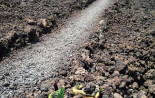
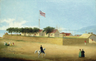
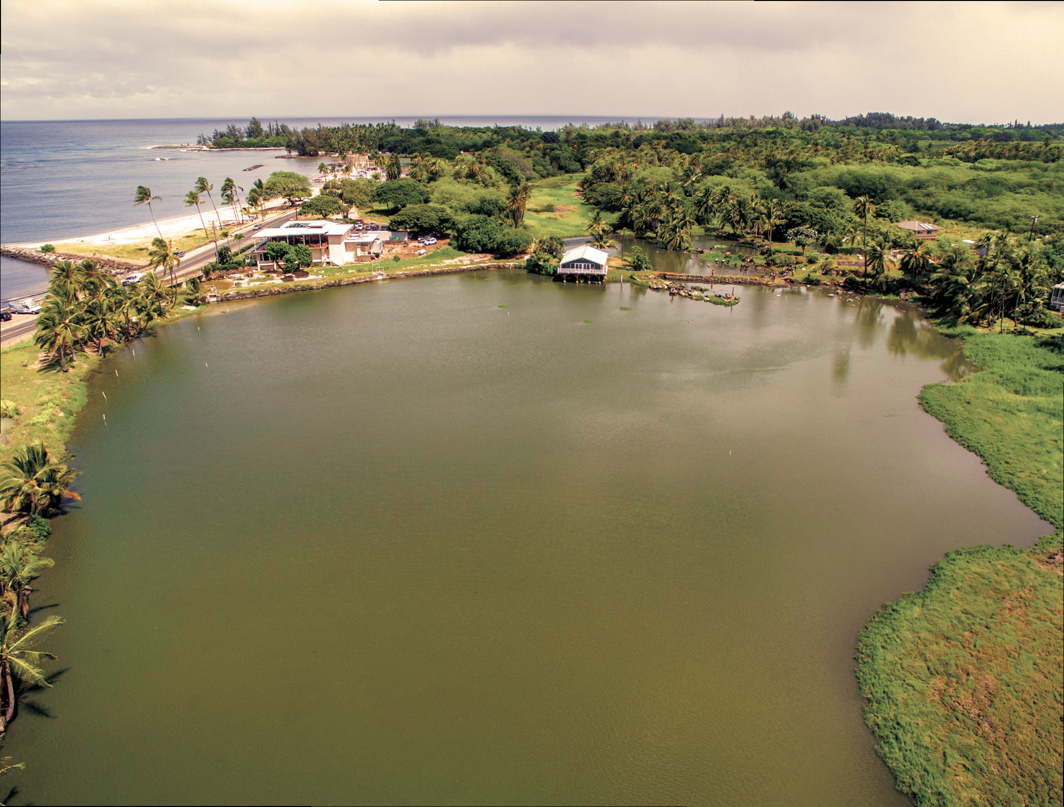
Ala Kahakai Mauka to Makai Trails (2016)

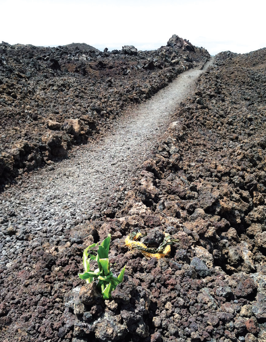
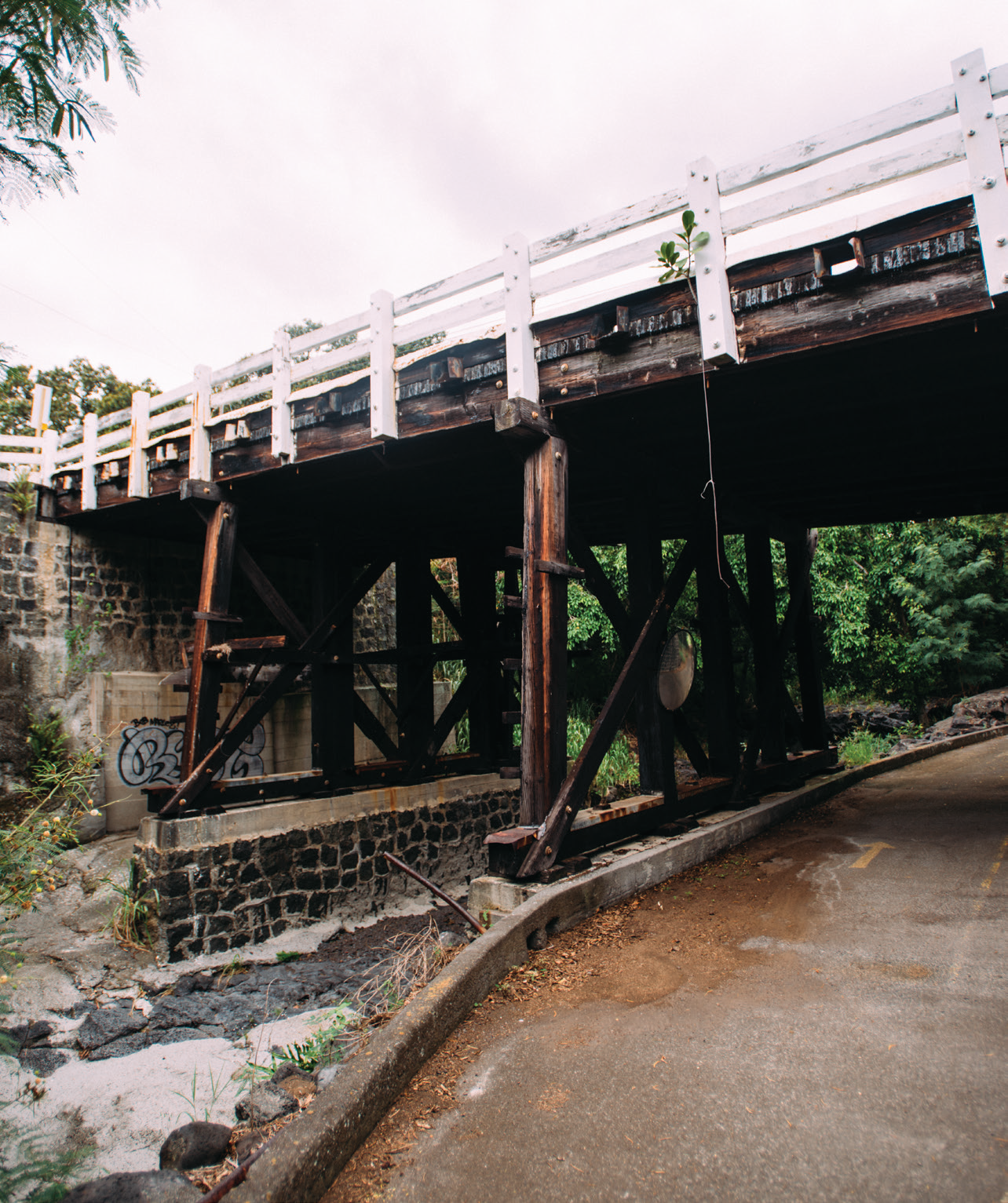
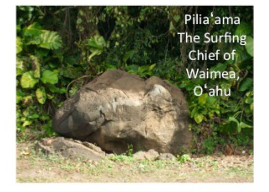
Photos: Courtesy of State Historic Preservation Division Article Written By: Katrina Valcourt, HONOLULU Magazine What is it? Ancient Hawaiians used a system of trails called ala loa to travel between ahupuaa in precontact Hawaii. Over time, many evolved from footpaths tp our modern highways, but the routes remain. One of the best preserved examples is a 175-mile trail on the Big Island called the Ala Kahakai. Portions of it are on the National Register of Historic Places, however, there are many other "in-between" trails that are not, especially connecting trails running mauka to makai. What threatens it? All ancient trails are threatened by forces of nature (suck as lava flows or landslides), neglect or development. It's especially hard to preserve the trails that have not been identified as part of the ancient system; however, when they are identified, the State Historic Preservation Division takes measures to protect and preserve them, according to administrator Alan Downer. "The difficulty is that we are often working with fragmentary information. So we may have bits of trail segments identified in a report but nothing to put them in context of a system of trails," he says. "In such instances, it is difficult to make really effective management decisions because we don't have the information we need to make better ones." According to Aric Arakaki, superintendent of the Ala Kahakai with the National Park Service, "Everything is voluntary on the part of the land owners and the public to preserve it." He says that about50 percent of the trail runs through private property. "Any place that you see development coming up, we're kind of worried." What can be done? Arakaki says, "Trails that fall outside of our corridor, if they [...]

2017-04-21T01:01:12-10:00November 17th, 2016|Categories: MES Hawaii|Tags: , |

Ninole Stream Bridge (2016)

Article Written By: Katrina Valcourt, HONOLULU Magazine What is it? THis is one of the last remaining timber bridges in the Hawaii state highway system, according to the State Historic Preservation Division's files. Built in 1940 by engineer William R. Bartels, the 60-foot historic bridge carries Mamalahoa Highway over Ninole Strea. Though 76 years ole, its wooden columns and railings remain structurally sound, but it's not wide enough for modern transportation needs and does not match other bridges in the system. What threatens it? THe Federal Highway Administration's Federal Lands Highway Division and the state Department of Transportation have proposed a replacement bridge that would be able to accommodate larger vehicles and be safer. The project overview states that, as of Setp. 1 the final Environmental Assessment is being prepared, maps are being reviewed and the project is almost 100-percent designed. Funding, however, hasn't been acquired yet. What can be done? Because the bridge is eligible for the Hawaii Register of Historic Places, someone can nominate it to the state register without having to get the Department of Transportation's permission (this is not the case for sites nominated to the national register). Being listed on the register wouldn't guarantee its protection, but the State Historic Preservation Division would have to review the demolition first and could ask for other proposals to be considered. The current proposal calls for a temporary bridge to be constructed next to the current one whole the new bridge is being built. If the temporary bridge were built as the permanent replacement, the original bridge could remain for pedestrians and bicyclists.

2017-04-21T01:01:15-10:00November 17th, 2016|Categories: MES Hawaii|Tags: , |

Loko Ea (2016)

Article Written By: Katrina Valcourt What is it? "Loko Ea is a 400-year-old fishpond and continues to be a cultural and educational learning center for our keiki and their families," says Rae DeCoiti, executive director of Malama Loko Ea Foundation, a steward of the pond since 2009. North Shore Outdoor Circle president Kerry Germain says the pond, which is home to many native species, was once the summer retreat of Queen Liliuokalani. What threatens it? Next to the pond, the space formerly occupied by a Chevron station, there are plans to build a retail complex called the Shops at Anahulu. Germain says the organization's primary concern is that it blocks the view of Loko Ea Pond from Kamehameha Highway (in violation of the Haleiwa Special District Land Use Ordinance) and eliminates the open space on the banks of the pond. "Malama Loko Ea Foundation and [landowner] Kamehameha Schools are working to restore the fishpond to be working aquaculture resource providing edible food, so the concerns for protecting water quality are obvious,"she says. It's not clear how the developers, Lokea Kai Partners LLC, will deal with possible runoff and their as-yet-unapproved septic system, though they have said it goes beyond the minimum safety requirements. In additions, Germain says Chevron was required to clean up the contaminated soil but submitted a report to the health department in July stating some of the contamination still remains. What can be done? As of September, Germain said a number of permits were still needed before the project could be undertaken, including: a construction plan approval, a building permit, a sewer connection permit and a street-usage permit. The organization is advocating for a conservation easement that would still provide revenue to [...]

2016-12-30T11:22:23-10:00November 17th, 2016|Categories: MES Oahu|Tags: , , |

Piliaama Stone (2016)

Photos: Courtesy of Ian Masterson Article Written By: Katrina Valcourt What is it? In Hawaiian lore, Piliaama was a konohiki, surfer and fisherman on the North Shore, until one day, when he was running away form an alii women who was in love with him, he vanishedm leaving nothing but his footprint in a large rock, about 3 feet tall and 4 feet wide, near Waimea Bay. Ian Masterson, noted surfer and WCC professor, says he discovered the stone after delving into Waimea's surfing history and reading Gilbert McAllister's description of it in Archaeology of Oahu (1933). He believes the stone should be honored as a scared site, perhaps as a place for offerings to the patron surfer of the bay. What threatens it? The Piliaama Stone sits very close to the road, only a few feet back form the asphalt. It is in danger of being hit by cars of nicked by tree-trimming equipment, which has already left marks on the front of it. If nobody knows it's there, Piliaama's story may be lost. What can be done? "How do we deal with sacred sites, do we leave them hidden or do we honor them? It feels like Piliaama should be honored," Masterson says. He suggests putting a sign  and short wrought-iron fence around it, like the Kahuna Stones in Waikiki, or even a small chain encircling the stone. But building a protective barrier may be a safety issue so close to Kamehameha Highway. Anyone who wants to take on this project would need to discuss it with the State Historic Preservation Division first. "For me, it would be great to be able to be a caretaker, remove brushes away from that area and clean the [...]

2016-11-17T10:23:57-10:00November 17th, 2016|Categories: MES Oahu|Tags: , , |

Kaniakapupu Ruins (2016)

Article Written By: Katrina Valcourt What is it? Kamehameha III's summer home, Kaniakapupu, built in the 1840s, is one of the last sites associated with Kauikeaouli and may be where part of the Great Mahele was written. That's according to Baron Ching, vice chair for Ahahui Malama o Kaniakapupu. It also served as a chief's children's school. "Every single high-ruling king or queen was within the walls of Kaniakapupu," Ching says. A plaque at the site declares there was once a luau held there in honor of Hawaiian Restoration Day, with 10,000 people in attendance, but not much is known about its use after 1847. Though many people hike to the ruins, the area is part of a restricted watershed and is off-limits to the public. What threatens it? Erosion remains a constant treat. In June, someone etched crosses into three of the walls, damaging the stone blocks and the integrity of the structure, as well as desecrating this important cultural site. (This is not the first time it's been vandalized, either.) Since then, others have attempted to scratch the crosses off, further degrading the 180-year-old palace. Google and Instagram searches reveal photos of people doing photo shoots, leaning on walls, and even climbing and sitting above the doorway. The Department of Land and Natural Resources has asked more than a dozen blogs to remove information and directions leading people to this restricted area, but social media make it accessible despite DLNR efforts. What can be done? "Over the years, we've discussed a lot of things," Ching says, including putting up a fence encircling the ruins, putting up more signs explaining their cultural significance and installing video cameras in the parking area. "Ultimately what needs [...]

2020-06-09T10:15:27-10:00November 17th, 2016|Categories: MES Oahu|Tags: , |

New Concept Design Unveiled for Waikiki War Memorial Natatorium

The National Trust for Historic Preservation contributes concept proposal in efforts to rehabilitate a one-of-a-kind war memorial to the men and women of Hawaii Swim Basin Rehabilitation Concept for Waikiki Natatorium War Memorial (Design: Dr. Hans Krock) On Veterans’ Day 2016, the National Trust for Historic Preservation unveiled its proposal for revitalizing the Waikiki War Memorial Natatorium —one of the most unique structures in the country commemorating those who served and gave their lives in World War I. The rehabilitation concept, designed by Hawaii’s globally-renowned engineer Dr. Hans Krock, is a simple, innovative and long-term solution that would ensure a clean and safe swim basin for the endangered memorial. “This concept proposal is part of our ongoing commitment to develop a collaborative preservation plan that once again allows the Natatorium to operate as a vibrant aquatic facility, community resource and ‘living memorial’ to be enjoyed by future generations,” said Barbara Pahl, senior vice president of field services for the National Trust. “We’re excited to contribute an environmentally responsible alternative—protecting public health and safety—and encourage the City and County of Honolulu and Hawaii locals to take a close look at the design and the opportunity to restore one of the state’s most recognizable historic sites.” The National Trust’s concept proposal for the Natatorium is the result of a collaborative effort with local experts and preservationists, which began with the site’s National Treasures designation in May 2014. The concept, developed by Dr. Hans Krock, Emeritus Professor of Ocean and Resources Engineering at the University of Hawaii at Manoa, and Dr. Alfred Yee, foremost authority in the design of concrete structures and consulting engineer for Pearl Harbor’s USS Arizona Memorial, addresses [...]

2017-10-04T23:49:27-10:00November 9th, 2016|Categories: Advocacy, Uncategorized|

Most Endangered Spotlight: Ninole Stream Bridge

The Most Endangered pau hana event at Laulima House on November 9 included a presentation of the 2016 Most Endangered Historic Places--succinctly summarizing each--what are they, what threatens them and what can be done to save them.  Here's a spotlight on Ninole Stream Bridge, one of the five sites added to this year's list. WHAT IS IT? Ninole Stream Bridge in Kau on Hawaii Island is one of the last remaining timber bridges in the state. Built in 1940 by engineer William R. Bartels, the 60-foot historic bridge has wooden columns and railings that are structurally sound. It was included in the 2013 Hawaii Department of Transportation (HDOT) Historic Bridge Inventory and determined to be eligible for the National Register of Historic Places. HDOT has determined the bridge to be of "High Preservation Value" due to its intact condition and rarity of design and materials. WHAT THREATENS IT? The Federal Highway Administration (FHWA) is proposing demolition of the bridge noting it's not wide enough for modern transportation. The plan is to build a replacement bridge with wider lanes to accommodate larger vehicles. WHAT CAN BE DONE? The current proposal calls for a temporary bridge to be built during construction, next to the historic bridge. If the parallel bridge is made permanent, the original bridge can be saved.  The historic bridge can then become a resource for the local community with use limited to pedestrians and bicycles.

2017-01-12T11:45:09-10:00November 8th, 2016|Categories: Blog|

ANNOUNCING Hawai‘i’s MOST ENDANGERED Historic Places of 2016!

What are Hawaii's Most Endangered Historic Places and why do they matter? The Most Endangered Historic Places is a public awareness campaign that seeks to remind people of historical sites that are often overlooked or forgotten. Sharing their connection to real people and events from the past that are still relevant today serves as a rallying cry for citizen action to protect these community landmarks. The annual list serves to highlight some of the best opportunities for preservation each year because the historic sites are threatened in some way, but still have opportunities for survival and reuse. Seven sites have been added this year with a total of 79 historic sites listed since 2005. The 2016 sites are: Ala Kahakai Mauka to Makai Trails Ninole Stream Bridge Kaniakapupu Ruins Loko Ea Piliaama Stone Read more about each site, why it’s relevant and what threatens it by clicking on each (above). Click here to read the full article by Katrina Valcourt in HONOLULU Magazine. The list of threatened historic properties is an annual program of Historic Hawai‘i Foundation, in partnership with the Hawai‘i State Historic Preservation Division and HONOLULU Magazine.  

2017-06-07T15:16:17-10:00November 8th, 2016|Categories: Blog|Tags: , , , , |

Honolulu Fort is Gone but the History Behind it Remains

200 years ago the Russians built a fort, and Fort Street is its namesake By Bob Sigall October 30, 2016  Honolulu Star-Advertiser Sunday Magazine This year 2016 is the 200th anniversary of the founding of Honolulu Fort at the waterfront. Very little remains of the fort, which was started by Russians who were interested in taking over the kingdom. Its enduring remnant is Fort Street, which began as a path from the fort leading mauka. In the early 1800s Russian fur traders began coming to the islands for fruit, vegetables, meat and other supplies. When Kamehameha the Great found out they were building a fort on land he had given them for a supply house, the king had them removed. The Russians met with King Kaumualii, the last king of Kauai, and conspired with him to take over the islands that Kamehameha controlled. They built four forts on Kauai. The remains of one, in Waimea, are still visible to this day. John Adams Kuakini, governor of Oahu, rebuilt the fort and extended its walls to a height of 16 feet and a thickness of 12 feet. It was rectangular and about 340 feet long and 300 feet wide. It enclosed about 2 acres. It was the largest structure in the islands at the time. The fort was made with coral blocks cut from the nearby reef, similar to those that would later build Kawaiaha‘o Church. A heavy wooden gate hung on massive iron hinges facing mauka, up Fort Street. It was located slightly makai of where Fort Street meets Queen Street today. Hawaiians referred to the fort as Kekuanohu (“thorny back,” because of the guns on it walls) or Kepapu (“the gun wall”), wrote Walter [...]

2017-04-21T01:00:54-10:00November 4th, 2016|Categories: Blog|

November 9 – Hawai‘i’s Most Endangered Historic Places Pau Hana

Join Historic Hawai‘i Foundation for an open house and reception at Laulima House in Makiki to see a success story of a threatened place that has been saved and to learn about other Endangered Places that can be preserved with thoughtful and timely action. (Photo courtesy of David Croxford: Laulima House, built in 1924, in the popular Beaux-Arts style in Makiki.) Most Endangered Pau Hana Wednesday, November 9 5:30 – 7:30 p.m. Historic Laulima House 1802 Ke‘eaumoku Street, Honolulu Tickets: $15 HHF Members/ $20 General General street parking available TICKETS Download Flier Watch for HONOLULU Magazine's November issue with the complete 2016 Most Endangered list due out November 1st! The annual list spotlights historic and cultural sites in Hawai‘i that are at risk of destruction or irreparable damage. The goal is to make the public aware of the threats facing these sites and galvanize action to preserve them. The event will include: Tours of the historic Laulima House (now being used for programs and services at Catholic Charities Hawaii) begin at 5:30 p.m. Presentation of the 2016 Most Endangered Places at 6:15 p.m. Updates from past years' lists Light refreshments Hosted by:

2017-04-21T01:00:54-10:00October 20th, 2016|Categories: Events - Past|
Go to Top