News

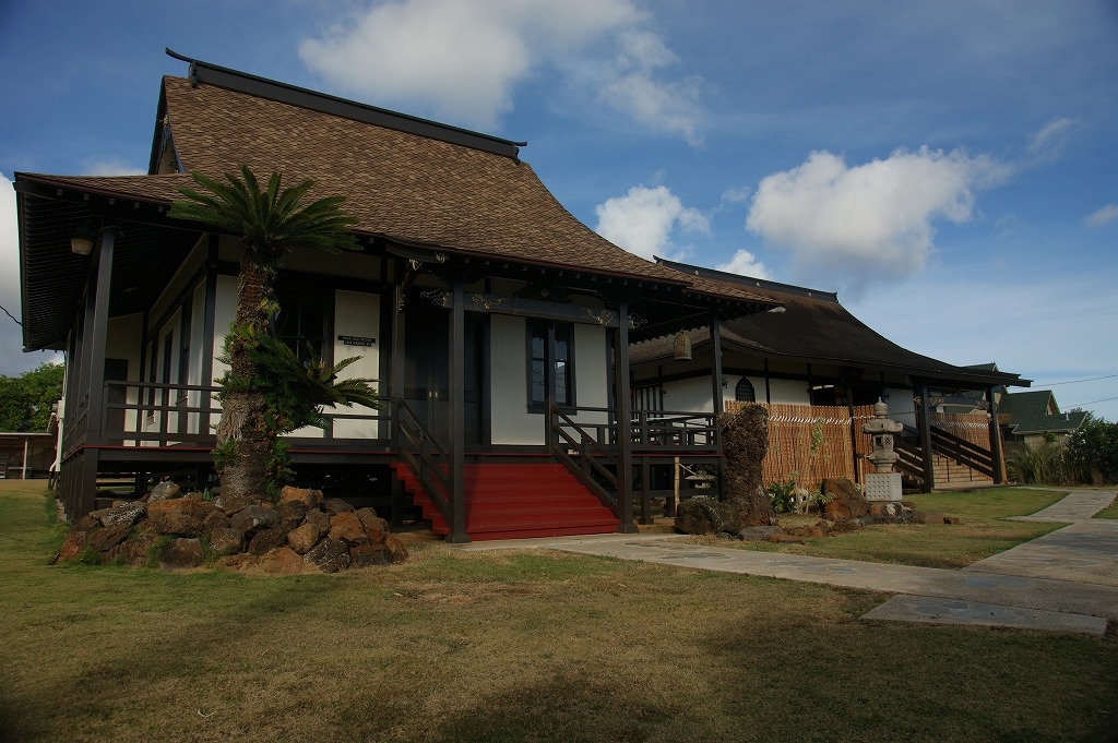
Kokee Park (2006) SAVED

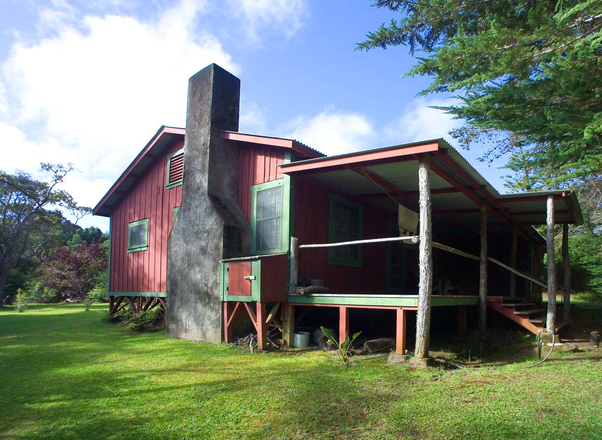
Photos: Courtesy of David Cornwell UPDATE: 2012 Hui o Laka renovated the historic and formerly abandoned Civilian Conservation Corps Complex (CCC Complex), both buildings and grounds, into a fully functioning volunteer service facility, in keeping with the original use in 1938. Constructed in 1935, as part of President Roosevelt’s national program “to provide work and job training for young men in conserving and developing the nation’s natural resources,” the  CCC Complex site accommodated many groups and programs over the years. This renovation is critical to protect and preserve a  complex of buildings that once served a national purpose, and stands as a landmark for the commitment of generations of people who have volunteered and dedicated themselves to community service in order to nurture Kōke‘e's native forest, and to educate visitor and kama‘āina alike. Hui o Laka received a Preservation Honor Award at Historic Hawai‘i Foundation’s 2012 Preservation Honor Awards Ceremony for the restoration of the Civilian Conservation Corps Camp Complex. UPDATE: SAVED IN 2011 According to Holly McEldowney of State Parks, auctions for leases on the last sixteen residences have been completed. Approval has been given for Mason Architects, Inc. to finish historic preservation design standards for the site. LISTED AS ENDANGERED IN 2006 Article Written By: Michael Keany, HONOLULU Magazine What is it? Ahh, Koke‘e, an idyllic 4,345 acres of mountainous Kaua‘i state park. It’s also home to 114 secluded recreational cabins—92 of them more than 50 years old—which have been caught in the middle of a preservation battle. The 20-year leases on the rustic cabins are set to expire at the end of this year, and the state plans to put them up for open auction, sparking heated protests from the current lessees, who [...]

2016-11-17T11:41:41-10:00March 3rd, 2014|Categories: MES Kauai|Tags: , |

Kekaha Sugar Mill (2007) LOST

Photos: Courtesy of Sue Boynton UPDATE: DEMOLISHED IN 2012 In 2012 the Kakaha Sugar Mill was demolished. LISTED AS ENDANGERED IN 2007 Article Written By: Michael Keany, HONOLULU Magazine What was it? Kekaha Town literally grew up around this mill. From the founding of Kekaha Sugar Co. in 1898 until the end of sugar operations in 2000, the mill provided the area its main economic driver, not to mention one of its most prominent landmarks: the smokestack that still towers above the town. It may not look it today, but the Kekaha Sugar Mill is actually the most modern sugar facility in Hawai‘i—it was built in 1954 as an upgrade to older, smaller mills before it. What threatened it? In a general sense, the wane of the sugar era on Kaua‘i means that plantation towns such as Kekaha and Lıhu‘e are faced with reinventing themselves. The mills that defined these towns may fall victim to the search for new commercial activity. Specifically, Pahio Development Inc., the company that bought the Kehaha Mill property earlier this year, and which also owns Lıhu‘e Mill, may be looking into replacing the structure with a new development, although president and CEO Lynn McCrory won’t say exactly what kind. “We’re still looking at the options for the site,” she says. “We’d like to take a bit more time looking at those possibilities and moving forward on them.” What could have been done? Jose Bulatao, vice-chair of the Kaua‘i West Side Watershed Council and a lifelong resident of Kekaha, says he wants Pahio Development to involve the Kekaha community in the discussion over what to do with the mill property. He acknowledges that it may be a costly endeavor to adapt [...]

2016-11-17T11:41:49-10:00March 3rd, 2014|Categories: MES Kauai|Tags: , |
  1. 1
  2. 2

Kōloa Jodo Mission (2007) SAVED

  UPDATE: SAVED IN 2010 Restoration of the building was completed in 2010. LISTED AS ENDANGERED IN 2007 Article Written By: Michael Keany, HONOLULU Magazine What is it? Built in 1909 by Rev. Jissei Muroyama, the Koloa Jodo Mission was one of Kaua‘i’s first Japanese temples, erected by immigrants who settled in the area. The mission built a larger temple to replace the aging structure in the 1980s, and it has since been used as a columbarium (a place for urns). Lorraine Minatoishi-Palumbo, an architect with expertise in Hawai‘i’s traditional Japanese architecture, calls the temple a fine example of early period Japanese temples built in the Islands, and says it’s one of only a handful still standing. What threatens it? The temple is beginning to feel its age, particularly in the past two years. The mission’s minister, Rev. Ishikawa, says, “We still use the building as a columbarium, but the ceiling is falling down and there’s also termite damage. I feel it’s become dangerous to use.” According to Minatoishi-Palumbo, the situation is a result of changing times. “What has been traditional in the upkeep of these temples is that the congregations would maintain them,” she says. “A lot of the Japanese men were carpenters, but everyone has gotten older.” At this point, many in the congregation are pushing to simply demolish the temple. Ishikawa says he’d like to save it, although he’s not sure what repairs would cost. What can be done? Minatoishi-Palumbo plans to submit the Koloa Jodo Mission to the state and national historic registers, which, if approved, will make it easier to apply for bricks and mortar grants. Another interesting prospect: A former minister of the temple, Rev. Kodo Tanaka, visited the [...]

2016-11-17T11:42:16-10:00March 3rd, 2014|Categories: MES Kauai|Tags: , |

Wainiha Stream Bridges (2007) LOST

Photos: Courtesy of Sue Boynton UPDATE: DEMOLISHED IN 2010 The Wainiha Stream Bridges were demolished as a result of structural failure from overloaded vehicles exceeding the bridge weight limit. LISTED AS ENDANGERED IN 2007 Article Written By: Michael Keany, HONOLULU Magazine What were they? A group of single-lane wooden timber bridges crossing the Wainiha Stream near Hanalei on Route 560. Since their construction in 1957, the low-profile, white-painted bridges have become an integral element of the rural character of the district, which is listed on both the Hawai‘i and National Register of Historic Places. What threatened them? The bridges are indisputably in terrible shape. State Department of Transportation inspectors have found heavy corrosion on the steel girders as well as rotting of some of the timbers. In fact, one of the bridges has already been replaced with a utilitarian-looking prefabricated modular steel bridge. DOT spokesperson Scott Ishikawa says the remaining two bridges are slated for demolition in mid-2009. “Temporary single-lane Acrow bridges will be installed, which will provide us some time to come up with a permanent bridge design that is safe and something the community is happy with,” he says. What could have been done? The problem is that the community is happy with the existing bridges. Susan Tasaki from the State Historic Preservation Division, as well as local community groups such as the Hanalei Road Committee, are pushing to repair and reinforce the structures instead of tearing them down. “These bridges should be repaired, replacing the existing materials in kind,” says Tasaki. “They’re not supposed to replace it with concrete. Nothing in the guidelines allows that.” Tasaki says the situation in Hanalei is indicative of a larger problem throughout Hawai‘i. Over the next [...]

2017-04-21T01:01:46-10:00March 3rd, 2014|Categories: MES Kauai|Tags: , |

Kekealiiwahine Heiau, Kailua-Kona (2005)

Photos: Courtesy of Macario UPDATE: December 2011 According to Holly McEldowney of State Parks Division, before improvements or major management efforts can begin, the division of state parks needs to amend its master plan and environmental impact statement to include these parcels.  This is dependent upon state funding.  In the meantime, Keakealaniwahine sustained damaged during the 2006 earthquake, while the 2010 tsunami ruined shoreline features at Keolonahihi. LISTED AS ENDANGERED IN 2005 Article Written By: A. Kam Napier, HONOLULU Magazine What is it? This complex features at least 29 known archaeological sites over more than 16 acres, including heiau, platform foundations and, most impressively, the remaining 10-foot high walls of chiefess Keakealaniwahine's home, dating back to about 1650. Only two women are known to have ever ruled the Big Island, Keakealaniwahine and her mother, Keakamahana. It was quite a family: Keakealaniwahine was also the great-great-grandmother of Kamehameha I. What threatens it? First Hawaiian Creditcorp acquired the complex though a foreclosure and donated it to the state in 1998. The state Department of Land and Natural Resources has reported that the complex suffers from natural and manmade deterioration and lacks comprehensive monitoring, restoration or interpretation. The site is also threatened by surrounding development. To date, none of these threats have been countered. What can be done? Some of this is about to change, says Martha Yent, state parks interpretive program supervisor. Keakealaniwahine and the nearby Keolonahihi State Historical Park have since been placed on the Hawai'i Register of Historic Places as the Holualoa Archaeological District. DLNR recently received $1.2 million in state and federal money to purchase a piece of private property between Keakealaniwahine and Ali'i Drive. "A lot of the Hawaiian community have asked us [...]

2016-11-17T10:48:00-10:00March 3rd, 2014|Categories: MES Hawaii|Tags: , |

Old Railroad Roundhouse, Hilo (2005)

Photos: Courtesy of Macario Article Written By: A. Kam Napier, HONOLULU Magazine What is it? Once the heart of Hilo's rail system, where engines were serviced, this roundhouse was actually a casualty of the April 1, 1946 tsunami that devastated Hilo. The wave didn't physically touch the 1921, eight-bay concrete roundhouse, but it destroyed nearby railroad tracks and bridges. A group of Big Island sugar plantations had run the trains as the Hawaii Consolidated Railroad. They decided to close the crippled railroad rather than repair it. Tsunami or no, closure was likely inevitable as plantations throughout the Islands moved to trucking, closing their rail lines around the late 1940s. Little else of Hilo's railroad history remains in the town. What threatens it? The roundhouse has been used for storage for decades by various construction Inc., which has used it since 1972 and owned it for the past 15 years. It has fallen into disrepair. What can be done? The roundhouse has its fans, but as yet, none with a specific plan for adopting and preserving the structure. Wayne Subica, owner of the Hilo museum Memories of Hawaii, would like to buy the roundhouse and use it for a museum of plantation history. "it's not in perfect condition, but its restorable, " he says. "It would be neat, I've got some railroad memorabilia and other people have a lot more. If that history isn't preserved, it will be lost. Bryson Saiki, President of Constructors Hawaii says, "We're open to suggestions. If an offer came in, we'd seriously consider it. To be honest, it's deteriorating and at some point it may become necessary to tear it down.

2017-04-21T01:01:47-10:00March 3rd, 2014|Categories: MES Hawaii|Tags: , |

Bond Homestead (2007)

Photos: Courtesy of Macario UPDATE: 2012 After severe damage by the 2006 earthquake, buildings of the Homestead had to be emptied of their many contents. These items were cataloged, and are now being preserved in climate controlled containers. The buildings themselves have been stabilized and await further restoration. When restoration of the Homestead is properly completed, it will serve as a museum housing a collection of historical artifacts and showcasing the rich history of the Bond family and the people of Kohala. Selected items from this collection will soon be on display at 'Iole’s new Exhibit Center adjacent to the Homestead. LISTED AS ENDANGERED IN 2007 Article Written By: Michael Keany, HONOLULU Magazine What is it? Although no one has lived in the homestead for 60 years, this house was once the home of Father Bond, a missionary who devoted his life to the Hawaiian community in Kohala. Built in 1840, it is the oldest wooden structure in Kohala, and, along with the former Kohala Girls School and various expansions to the main house, is part of the 54-acre Bond Historic District. In 1999, the Bond family sold the estate to the New Moon Foundation, a nonprofit organization. What threatens it? In the ’06 earthquake, many of the stone buildings on the estate, including Bond’s office, suffered the same type of damage that the Kalahikiola Church did, with walls collapsing outward from the shaking. New Moon has temporarily shored up the structures, and retained Mason Architects to evaluate the damage. What can be done? Although the buildings lie within the Bond Historic District, the designation does not legally compel the private landowners to rebuild them. Ultimately, it’s up to New Moon to decide what it [...]

2017-04-21T01:01:47-10:00March 3rd, 2014|Categories: MES Hawaii|Tags: , |

Kalahikiola Congregational Church (2007) SAVED

Photos: Courtesy of Macario UPDATE: SAVED IN 2010 The Hawai‘i Conference Foundation, Kalahikiola Congregational Church, Mason Architects, Inc., Kikiaola Construction Company, Tanimura & Associates, Inc, and Wallace T. Oki, P.E., Inc. recieved a Preservation Award in 2010 for the reconstruction of the historic Kalahikiola Church after earthquake damage sustained in October 2006. LISTED AS ENDANGERED IN 2007 Article Written By: Michael Keany, HONOLULU Magzine What is it? This North Kohala church was founded by missionary Rev. Elias Bond and his wife, Ellen, who arrived in 1841. Determined to build a church that would stand the test of time, parishioners carried stones by hand from the surrounding areas for the walls, and constructed the roof from hand-hewn ‘ohia wood held together with mortise and tenon joints. The church was dedicated in October 1855, and today has been placed on both the national and state historic registers. What threatens it? Until October of last year, the thick, stone walls of the church looked plenty sturdy, but over the years, the coral mortar used by the original builders had dried and crumbled back into sand. When the 6.7 magnitude earthquake rocked the Big Island, large sections of the walls crumbled into piles of rubble on the lawn, turning the church into a media poster child of the earthquake’s devastation. Miraculously, the structure didn’t collapse entirely, and the congregation was able to temporarily shore up the walls, keeping the church upright until permanent repairs can be made. What can be done? Glenn Mason, the architect hired to rebuild the church, says that at least 90 percent of the walls need to be replaced. “The challenge is going to be saving the rest of the building—the floors, the roof—and we’re [...]

2016-11-17T10:48:28-10:00March 3rd, 2014|Categories: MES Hawaii|Tags: , |

Lapakahi (2009) SAVED

Photos: Courtesy Kirk Lee Aeder UPDATE: SAVED IN 2011 Coastal Property Added To Lapakahi State Historical Park Endangered Historic Property HONOLULU, March 18, 2011 - The State of Hawai‘i, Department of Land and Natural Resources, Division of State Parks announced the addition of 17 shoreline acres to Lapakahi State Historical Park in North Kohala on the Island of Hawai‘i, located in an area traditionally known as Nu‘uanu. The parcel will be added to the Lapakahi State Historical Park, which is listed in the National and Hawai‘i Registers of Historic Places as an excellent example of a leeward coastal settlement that spans a 600 year period from circa A.D. 1300 to the early 1900s. The 17-acre parcel has significant cultural sites that are part of this larger Lapakahi complex and the potential for development of the parcel under private ownership resulted in its recent listing as one of Hawai'i's Most Endangered Places by Historic Hawai‘i Foundation. "This parcel was surrounded on three sides by Lapakahi State Historical Park with the fourth side being adjacent to the Lapakahi Marine Life Conservation District. It has been the State’s desire for many years to acquire this property and include it within the park as part of the larger Lapakahi complex. The 17 acres are a vital piece of a cultural and biological landscape of the Kohala coastline, and we are thankful that future generations will have an opportunity to appreciate this cultural complex within its natural setting and to enjoy the open space and access to the shoreline," stated William Aila, Jr., Director of the Department of Land and Natural Resources. The acquisition was assisted by a diverse public-private partnership of Kohala community organizations, the Trust for Public Land (a [...]

2016-11-17T10:48:37-10:00March 3rd, 2014|Categories: MES Hawaii|Tags: , |

Lower Hāmākua Irrigation Ditch (2013)

  Video Credit to Save Our Hamakua Heritage Ditch: http://youtu.be/EX4thP2acJE Article Written By: Victoria Wiseman, HONOLULU Magazine What is it? The Lower Hamakua Irrigation Ditch is an irrigation system and waterway that was used during the sugar plantation era. It was excavated in 1906, not just for watering sugar crops but also for sending the cane to the mill for processing. Its total length is about 26 miles, including tunnels, flumes to control water flow and open ditches with stone walls. Community members say that, because of the ditch’s role as a community water source and home to micro- ecosystems that include wildlife such as crayfish, ducks and dragonflies, it’s more of a historic waterway than a simple water distribution system. “We don’t have many streams in the state of Hawaii; this is essentially a stream with an ecosystem,” says Margaret Wille, an attorney and Hawaii County council member. “This connects the community from the past to the future,” she says. What threatens it? In 2004, heavy rains collapsed part of the ditch, blocking off the transfer of water, says Glenn Okamoto, an engineer for the state Department of Agriculture. The state applied for a FEMA grant to rebuild the section, which was approved. The department’s proposed fixes enclose and bury a five-mile section of the irrigation ditch, which critics like Wille say would destroy the spirit of this historic property. As the project went through the approval process, a memorandum from the state historic preservation division said that the project would have an inverse effect on historic properties, and required some additional study and documentation. When the community was notified on the eve of its execution, it immediately mobilized and protested to FEMA and [...]

2017-04-21T01:01:47-10:00March 3rd, 2014|Categories: MES Hawaii|Tags: , |
Go to Top