#Honokaa #HistoricHawaii

View the recording: The Multilayered History of Kōloa: A Virtual Presentation

The Multilayered History of Kōloa A Virtual Presentation   Thursday, November 14, 2024 12:00 to 1:00 p.m. Virtual (via Zoom) Cost: Free, registration required VIEW THE EVENT RECORDING BELOW Click the image at left to view the webinar slide deck. LISTEN Journalist Catherine Cruz interviewed Dr. Hal Hammatt and Erica Kamālamalamaonālani Ishii about Kōloa and the Kōloa Story Map on Hawai‘i Public Radio's The Conversation, November 13, 2024. Question: What is the estimate for the number of people supported by and lived/worked in the Kōloa area at its peak? Dr. Hammatt: The estimated extent of what we know as Kōloa Field System was approximately 2,400 acres extending from Lawa‘i from the west and Weli Weli to the east. Based on this extent and production of the field system there were likely estimated a few thousand during pre-Contact period. Post-Contact documentation including Judd (1932) states they "observed that the population of Kōloa must have been several thousand before European contact." It was also stated the population in the early 1840s were "about two thousand people, including many foreigners" (James Jackson Jarves 1844), however, other sources such as a report by missionaries on Kaua‘i, the inhabitants of the ahupua‘a numbered 2,166 (cited in Palama and Stauder 1973:16; also found in the newspaper, Garden Island, 27 July 1935). However, in this census, the designation of Kōloa was used to refer to the whole area between Wahiawa and Kalapakī. An article in the Pacific Commercial Advertiser of December 21, 1867 estimated that the population in 1838 was about 3,000, though by 1867, it had been reduced to a third of [...]

2024-11-20T22:19:14-10:00October 22nd, 2024|Categories: Events, Events - Home sidebar, Featured Homepage Top|Tags: |

View the recording: The Honokaʻa Story Map Project: Presentation and Panel Discussion

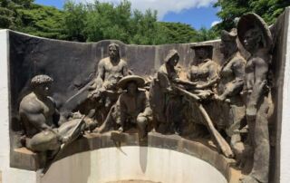
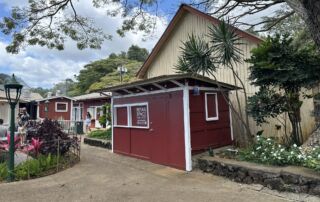
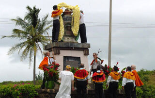
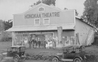
Sharing the Multilayered History of Honokaʻa Presentation and Panel Discussion Friday, June 3, 2022 11:00 a.m. to 12:15 p.m. Virtual (via Zoom) Cost: Free, registration required VIEW THE EVENT RECORDING BELOW Historic Hawai‘i Foundation and our project partners are excited to introduce the Honoka‘a Story Map! Click the PHOTO ABOVE to access the Honoka‘a Story Map. Honoka‘a Story Map: He Koaʻe, Manu o ka Pali Kahakō Historic Hawai‘i Foundation developed the Honoka‘a Story Map in collaboration with project partners, Cultural Surveys Hawai‘i; the University of Hawai‘i at Hilo, History Department and Professor Kerri Inglis; Honoka‘a Heritage Center and members of the Historic Honoka‘a Town Project. Students from UH Hilo contributed to the research and content of the map as part of their history course curriculum under the direction of Professor Inglis. The project also enlisted three student interns who worked closely with Professor Inglis and contributed research, contextual essays, and photography. Honoka‘a Presentation and Panel Discussion More than 120 people joined HHF on June 3, 2o22 for a virtual presentation and panel discussion with Honoka‘a Heritage Center executive director Nicole Garcia, UH Hilo History Professor Kerri Inglis, and a student panel. The discussion shared the context, process, and purpose of the Honoka‘a Story Map, along with reflections from the students themselves relaying how this project has impacted their view of Honoka‘a and the surrounding area, themselves, and their own sense of place. Historic Hawai‘i Foundation has partnered with Cultural Surveys Hawai‘i, the University of Hawai‘i at Hilo, History Department, Honoka‘a Heritage Center, and Historic Honoka‘a Town Project to create the Honoka‘a Story Map. Students from UH Hilo are contributing to the research [...]

2022-07-25T13:02:21-10:00May 9th, 2022|Categories: Events - Past|Tags: |
Go to Top