Oahu

Fort Kamehameha (2008)

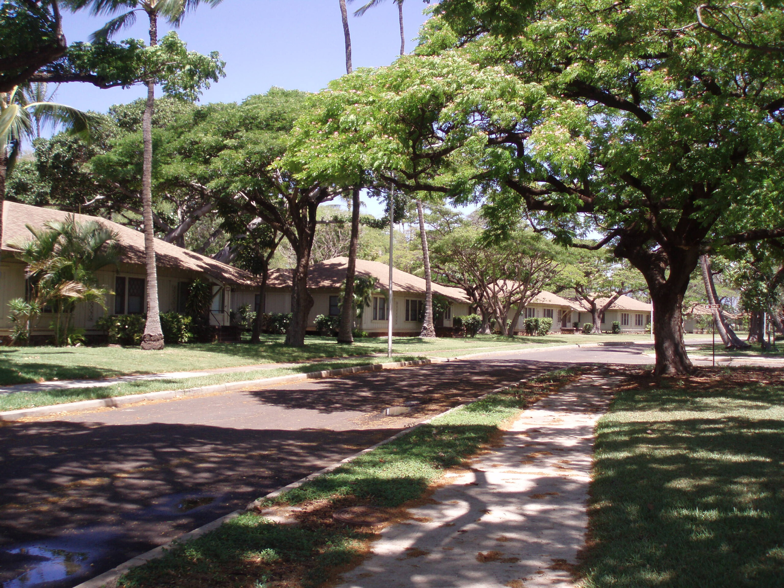
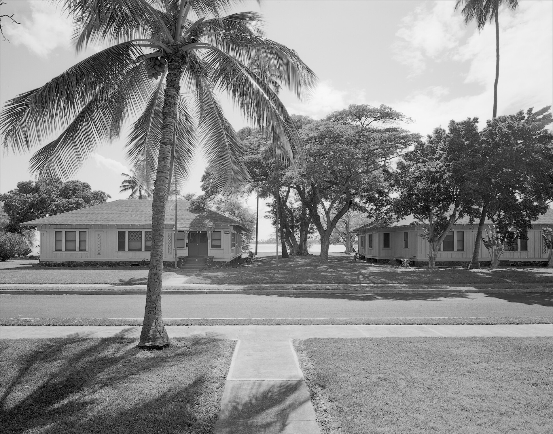
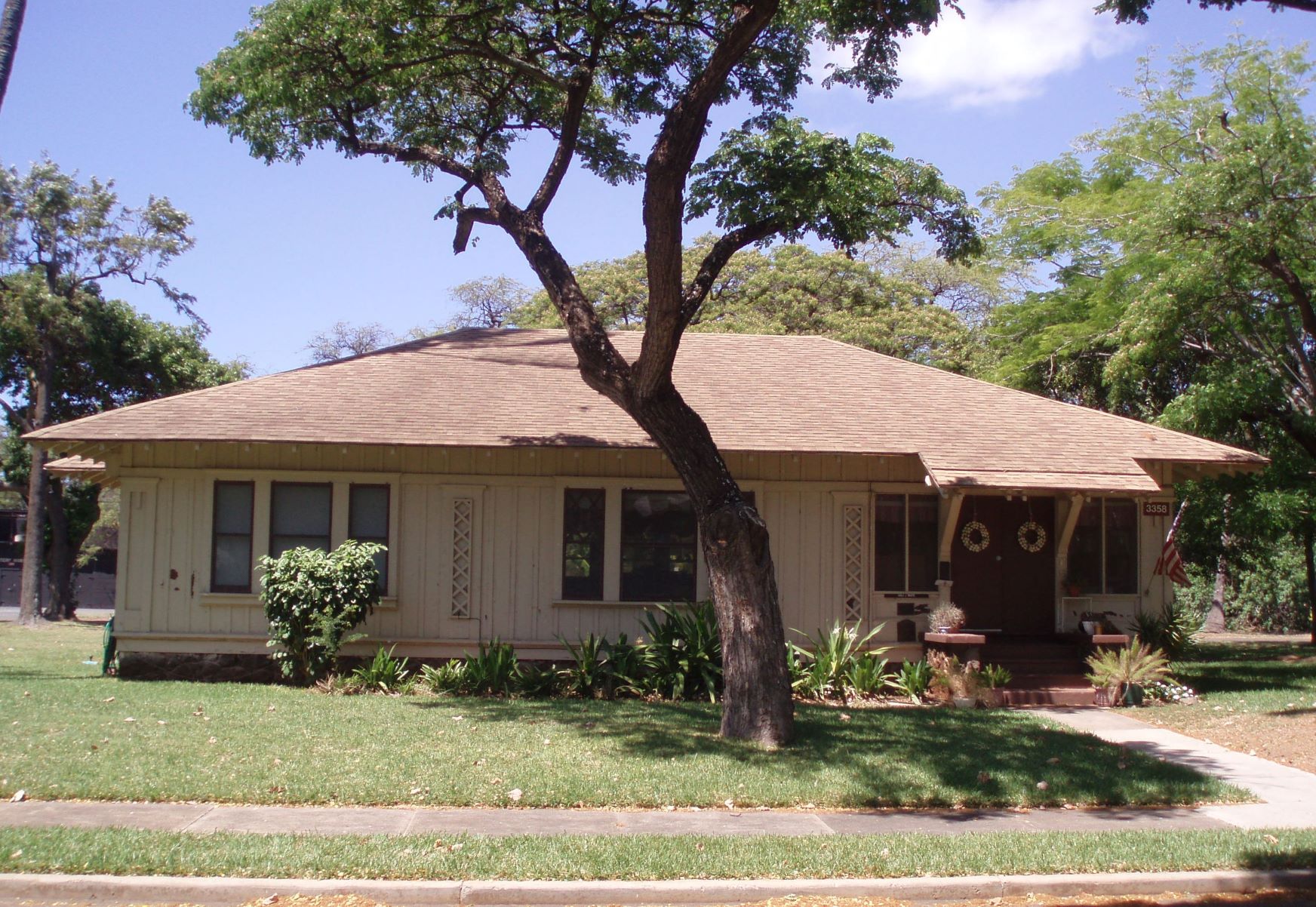
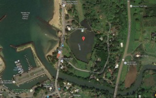
UPDATE: 2022 PUBLIC WELCOME TO COMMENT ON NAVY'S PROPOSAL TO DEMOLISH THE FT. KAMEHAMEHA HISTORIC HOUSING DISTRICT In a letter addressed to Dr. Alan Downer, Deputy State Historic Preservation Officer, Department of Land and Natural Resources and dated August 31, 2021, the Commander of Navy Region Hawai‘i initiated Section 106 Consultation for disposal of the Fort Kamehameha houses at Joint-Base Pearl Harbor-Hickam (JBPHH).  Historic Hawai‘i Foundation (HHF) is engaged as a consulting party, along with the State Historic Preservation Office (SHPD), Advisory Council on Historic Preservation and other parties. The remaining 33 houses are currently in a mothballed status. Navy states that this action was coordinated with the SHPD during the development of the Fort Kamehameha Environmental Impact Statement Alternatives for the Disposition of Fort Kamehameha Historic District Buildings and Structures by the Air Force in 2009. Lead and asbestos abatements were recently completed for 3 homes. Built in 1916, Fort Kamehameha was originally an Army Coastal Artillery Post. After World War II, coastal artillery became obsolete and most of the non-residential buildings were demolished. The remaining 33 homes stand as premier examples of the Bungalow/Arts and Crafts style of the era. Currently, Fort Kamehameha Housing Historic District consists of 48 buildings and structures that include officers’ housing, a chapel, bandstand, flagpole and abandoned gun batteries. The district also includes archaeological sites, a burial vault for reinternment of human remains, mature trees and landscaping in open green space and a circulation system of streets and sidewalks. The district was transferred from Army to the Air Force, then came under the Navy’s jurisdiction with joint basing in 2010. HHF added the district to the Most Endangered list in 2008 when the military moved out the residents, [...]

2022-07-20T13:44:44-10:00April 12th, 2022|Categories: Advocacy, Blog, MES Oahu|Tags: , |

Loko Ea (2016)

Article Written By: Katrina Valcourt What is it? "Loko Ea is a 400-year-old fishpond and continues to be a cultural and educational learning center for our keiki and their families," says Rae DeCoiti, executive director of Malama Loko Ea Foundation, a steward of the pond since 2009. North Shore Outdoor Circle president Kerry Germain says the pond, which is home to many native species, was once the summer retreat of Queen Liliuokalani. What threatens it? Next to the pond, the space formerly occupied by a Chevron station, there are plans to build a retail complex called the Shops at Anahulu. Germain says the organization's primary concern is that it blocks the view of Loko Ea Pond from Kamehameha Highway (in violation of the Haleiwa Special District Land Use Ordinance) and eliminates the open space on the banks of the pond. "Malama Loko Ea Foundation and [landowner] Kamehameha Schools are working to restore the fishpond to be working aquaculture resource providing edible food, so the concerns for protecting water quality are obvious,"she says. It's not clear how the developers, Lokea Kai Partners LLC, will deal with possible runoff and their as-yet-unapproved septic system, though they have said it goes beyond the minimum safety requirements. In additions, Germain says Chevron was required to clean up the contaminated soil but submitted a report to the health department in July stating some of the contamination still remains. What can be done? As of September, Germain said a number of permits were still needed before the project could be undertaken, including: a construction plan approval, a building permit, a sewer connection permit and a street-usage permit. The organization is advocating for a conservation easement that would still provide revenue to [...]

2016-12-30T11:22:23-10:00November 17th, 2016|Categories: MES Oahu|Tags: , , |

Piliaama Stone (2016)

Photos: Courtesy of Ian Masterson Article Written By: Katrina Valcourt What is it? In Hawaiian lore, Piliaama was a konohiki, surfer and fisherman on the North Shore, until one day, when he was running away form an alii women who was in love with him, he vanishedm leaving nothing but his footprint in a large rock, about 3 feet tall and 4 feet wide, near Waimea Bay. Ian Masterson, noted surfer and WCC professor, says he discovered the stone after delving into Waimea's surfing history and reading Gilbert McAllister's description of it in Archaeology of Oahu (1933). He believes the stone should be honored as a scared site, perhaps as a place for offerings to the patron surfer of the bay. What threatens it? The Piliaama Stone sits very close to the road, only a few feet back form the asphalt. It is in danger of being hit by cars of nicked by tree-trimming equipment, which has already left marks on the front of it. If nobody knows it's there, Piliaama's story may be lost. What can be done? "How do we deal with sacred sites, do we leave them hidden or do we honor them? It feels like Piliaama should be honored," Masterson says. He suggests putting a sign  and short wrought-iron fence around it, like the Kahuna Stones in Waikiki, or even a small chain encircling the stone. But building a protective barrier may be a safety issue so close to Kamehameha Highway. Anyone who wants to take on this project would need to discuss it with the State Historic Preservation Division first. "For me, it would be great to be able to be a caretaker, remove brushes away from that area and clean the [...]

2016-11-17T10:23:57-10:00November 17th, 2016|Categories: MES Oahu|Tags: , , |

Kaniakapupu Ruins (2016)

Article Written By: Katrina Valcourt What is it? Kamehameha III's summer home, Kaniakapupu, built in the 1840s, is one of the last sites associated with Kauikeaouli and may be where part of the Great Mahele was written. That's according to Baron Ching, vice chair for Ahahui Malama o Kaniakapupu. It also served as a chief's children's school. "Every single high-ruling king or queen was within the walls of Kaniakapupu," Ching says. A plaque at the site declares there was once a luau held there in honor of Hawaiian Restoration Day, with 10,000 people in attendance, but not much is known about its use after 1847. Though many people hike to the ruins, the area is part of a restricted watershed and is off-limits to the public. What threatens it? Erosion remains a constant treat. In June, someone etched crosses into three of the walls, damaging the stone blocks and the integrity of the structure, as well as desecrating this important cultural site. (This is not the first time it's been vandalized, either.) Since then, others have attempted to scratch the crosses off, further degrading the 180-year-old palace. Google and Instagram searches reveal photos of people doing photo shoots, leaning on walls, and even climbing and sitting above the doorway. The Department of Land and Natural Resources has asked more than a dozen blogs to remove information and directions leading people to this restricted area, but social media make it accessible despite DLNR efforts. What can be done? "Over the years, we've discussed a lot of things," Ching says, including putting up a fence encircling the ruins, putting up more signs explaining their cultural significance and installing video cameras in the parking area. "Ultimately what needs [...]

2020-06-09T10:15:27-10:00November 17th, 2016|Categories: MES Oahu|Tags: , |

Marconi Wireless Telegraph Station (2012)

Photos: Courtesy of Rae Huo; Hawaiian Collection, Hamilton Library at UH Manoa UPDATE: 2015 Article Written By: Katrina Valcourt, HONOLULU Magazine Not much has happened with this site, though owner Jeremy Henderson says they’ve done some minor cleanup to improve the view, secured the buildings for safety reasons and gotten the station onto both state and national historic registers (Marconi Nomination). “We’d still like to preserve the historic buildings,” Henderson says. “Next, we’re planning a market feasibility study” to determine the options for adaptive reuse. Listed as Endangered in 2012 Article Written By: Kathryn Drury Wagner, HONOLULU Magazine What is it? On an oceanfront parcel of land in Kahuku, tucked between Turtle Bay’s golf course and shrimp farms, the Marconi Wireless Telegraph Station gives us a rare glimpse into telecommunications history. The station’s name refers to Guglielmo Marconi, who invited and commercialized a way to transmit Morse signals wirelessly across great distances. Hawai’i was at the forefront in the use of this technology, and when the Kahuku station was built in 1914, it was the largest wireless telegraph station in the world in terms of capacity and power. By 1916, there was regular telegraphic communications between Hawai’i and Japan, a distance of 4,200 miles. The property was purchased by Marconi Point LLC in 2005, says owner Jeremy Henderson. It’s one of only two remaining telegraph stations in Hawai’i (the Koko Head station’s hotel building became Lunalilo’s Home in 1928), and one of only a handful in the country. Receiving stations in Marshall, Calif., and Belmar, N.J., also remain standing. What threatens it? Telegraph declined after Hawai’i was linked to the Mainland by undersea telephone cable in 1957 and, today, the buildings at Marconi station sit vacant and in disrepair. Until Henderson can come up with the right [...]

2016-11-17T11:07:08-10:00November 1st, 2015|Categories: MES Oahu|Tags: , |

Omega Station/ Ha’iku Stairs (2015)

Photography: Courtesy of Friends of Ha'iku Stairs Article Written By: Katrina Valcourt, HONOLULU Magazine What is it? The controversial Stairway to Heaven in Ha‘ikū Valley, consisting of approximately 3,922 steps, was built as a means to reach antennae and transmission facilities on the mountain ridges, used to broadcast signals from the top-secret Ha‘ikū Radio Station commissioned during World War II. What started as a relay station to communicate with naval ships became an Omega navigation station in the 1960s, one of eight stations worldwide. Despite having the most advanced and complex antenna system of its time, the station was decommissioned in 1997 when GPS took over. What threatens it? The station sits in disrepair and has been heavily vandalized over the years. On the mauka side of the H-3, the stairs, which have been officially off limits for decades, suffer from wear-and-tear caused by hikers and were damaged by a storm in mid-February. The Board of Water Supply owns the stairs but does not want to manage them, and plans to tear them down, for safety reasons as well as to save money on security and prevent hikers from trespassing through the neighborhood. Mahealani Cypher of the Ko‘olau Foundation says the area could be used for cultural and educational purposes, and tearing down the stairs would cause damage to the native ecosystem. What can be done? Though BWS is looking into what it would cost to remove the stairs, it would prefer to have another agency take control of them. “We’ve approached a number of government agencies and, so far, everyone’s turned us down,” says Ernest Lau, manager and chief engineer at BWS, which remains open to discussions. Cypher says the Ko‘olau Foundation, along with others, including the Friends of Ha‘ikū Stairs, wants to transform the Omega station into a cultural museum. The landowner, the Department of Hawaiian Home Lands, has had some preliminary discussions [...]

2016-11-17T09:09:47-10:00November 1st, 2015|Categories: MES Oahu|Tags: , |

Kanewai Spring Complex (2015) SAVED

UPDATE, July, 2017 - SAVED:  Nonprofits, government, community members and the private sector worked together successfully to purchase and forever protect this, one of Honolulu’s last natural springs to still provide fresh, clean water to the shore. Once overgrown, dark, and murky - Kānewai Spring and the surrounding land are now brimming with life thanks to seven years of hard work by the Maunalua Fishpond Heritage Center and hundreds of volunteers. And now, the site is permanently protected and owned/stewarded by the community via nonprofit Maunalua Fishpond Heritage Center. The conservation funding which saved the spring is described in a Trust for Public Land (TPL) press release from July, 2017: “To fund the conservation purchase, the State Department of Land & Natural Resources Legacy Land Conservation Program granted $1.3 million. The City and County of Honolulu Clean Water and Natural Lands Program (TPL) contributed an additional $1 million, providing the Trust for Public Land with the $2.3 million needed to purchase and preserve the property in perpetuity. Local foundations and donors raised $350,000 to cover costs for the real estate transaction and expenses for land management. The land is now permanently protected through a conservation easement with binding restrictions that will be monitored and enforced by the City and area nonprofit Livable Hawai‘i Kai Hui."   Threatened - 2015 Photography: Courtesy of John Johnson Article Written By: Katrina Valcourt, HONOLULU Magazine What is it? Prior to Henry J. Kaiser’s development of Hawai‘i Kai, the area boasted one of the largest fishponds on O‘ahu. Now, only a few fishponds remain on the East Side, including the Kanewai Fishpond, which is fed by a freshwater spring that ancient Hawaiians relied on when they lived in the caves above. The fishpond is connected to [...]

2018-03-19T12:12:11-10:00November 1st, 2015|Categories: MES Oahu|Tags: , |

Board of Water Supply Beretania Buildings (2013)

UPDATE: November, 2018 Public Meeting on Redevelopment of the Board of Water Supply Complex Set for Thursday, November 8, 2018 The Board of Water Supply will be issuing a Request for Proposal to redevelop a portion of its Beretania Complex. A presentation and public meeting is scheduled for Thursday, November 8. The Complex is home to three historically-significant buildings.  The current Request for Proposal includes the adjacent parking lots, but not the historic buildings. A previous proposal (2013) would have allowed demolition of the Hart Wood-designed administration building, which lead Historic Hawai‘i Foundation to list it as one of the Most Endangered Historic Properties in Hawai‘i. The Board of Water Supply then withdrew the prior concept to “regroup.” The current proposal appears to avoid the sensitive sites. UPDATE: 2015 Article Written By: Katrina Valcourt The Board of Water Supply withdrew its request for proposal to develop the land after all interested developers backed out. “We’re regrouping,” says Ernest Lau, manager and chief engineer of BWS. “We intend to rethink the process and go out with another RFP in the next couple of years, but probably not to touch any of the existing buildings. I think people have a lot of emotional connection to the architect who designed some of these buildings (Hart Wood).” BWS will instead focus on infrastructure upgrades and becoming accessible. Lau says they are also considering resubdividing the land into more developable parcels, or rezoning the site to give developers more flexibility. Listed as Endangered in: 2013 Article Written By: Victoria Wiseman, HONOLULU Magazine What is it? Fronting Beretania Street, the Honolulu Board of Water Supply was designed by architect Hart Wood, founder of the Hawaii Regional Movement. Created at the end of his career and life, the Pumping Station was built in 1917, the Engineering Building built in 1938, and the Administration [...]

2018-11-02T11:10:04-10:00November 1st, 2015|Categories: MES Oahu|Tags: , |

Neal Blaisdell Center-Concert Hall And Arena (2014)

Photography: Courtesy of David Croxford Article Written By: Loren Moreno, HONOLULU Magazine What is it? The Neal S. Blaisdell Center opened in 1964 as Honolulu’s first convention center, known at the time as the Honolulu International Center. Encompassing nearly a whole city block along Ward Avenue, between Kapi‘olani Boulevard and King Street, two of the three original structures remain on the site—the Blaisdell Concert Hall and the Blaisdell Arena. At the time, the center was celebrated as the city’s first step toward becoming a major U.S. city. Over the years, the concert hall and arena have hosted the Honolulu Symphony, Broadway musicals, college sporting events and major artists, including Elvis Presley’s 1973 “Aloha from Hawai‘i” concert, credited as the first program to be beamed around the world by satellite. Like many of Honolulu’s buildings, Blaisdell Center comes out of the 1950s and 1960s modern architectural movement, says Gushard, of DoCoMoMo. “On O‘ahu, the built environment is defined by that era,” he says. What threatens it? The property is threatened by development. Now 50 years old, the buildings suffer from deferred maintenance, and the city is creating a master plan based on recommendations from several community and private organizations, including the Honolulu Community Development Authority, overseeing the development of Kaka‘ako. Most recently, the Urban Land Institute said the city has an “iconic opportunity” to redevelop the property. With a rail station planned near the center, the city is also under pressure to redevelop for transit. Curtis Lum, spokesman for the city’s Department of Planning and Permitting, says no decisions have been made about the site. What can be done? Members of the public should make their opinions known, says Gushard. “The government on O‘ahu tends to [...]

2015-03-06T10:50:55-10:00December 8th, 2014|Categories: MES Oahu|Tags: , |

Valley of the Temples (2014)

Photography: Courtesy of David Croxford Article Written By: Loren Moreno, HONOLULU Magazine What is it? A landmark along Kahekili Highway, the family services building at Valley of the Temples is one of the few remaining structures designed by resort architect George Pete Wimberly. The building was designed to mimic a Native Hawaiian heiau, using the tools of modern architecture, including its expressive skyward arch. The building serves as the headquarters for Valley of the Temples’ administrative staff. Wimberly’s work has not survived well in the face of urban development, particularly because his work was so “exuberant and odd,” says Mike Gushard, president of the Hawai‘i chapter of DoCoMoMo (Documentation and Conservation of the Modern Movement). But that’s what makes it work worth saving, hesays. “It’s a building that could only exist in Hawai‘i.” What threatens it? Valley of the Temples, now owned by NorthStar Memorial Group, is considering demolishing the building to replace it with a mortuary and crematorium, according to information provided to both the Historic Hawai‘i Foundation and the state Historic Preservation Division. Mark Gilmore, the cemetery’s area operations director, was unwilling to confirm or deny the plans. Faulkner says concepts include building a 30,000-square-foot funeral home on the current site of the administration building. What can be done? Because the building is more than 50 years old, the state requires that a historic review be done prior to any demolition or redevelopment. “In that review process, there is a place for the community to say, ‘Give this a second thought,’” Gushard says. At the end of the day, though, owners of private property are allowed to make the final decision.

2014-12-08T09:32:39-10:00December 8th, 2014|Categories: MES Oahu|Tags: , |
Go to Top